|
All Other |
551 1/4/2/8/1 |
Drawings created during RCAHMS Achiltibuie project |
1994 |
Batch Level |
|
All Other |
551 1/4/2/8/2 |
Photographic copies of drawings |
|
Batch Level |
|
Digital Files (Non-image) |
DX 001424 |
RCAHMS Structures Database - Achiltibuie |
1994 |
Item Level |
|
Digital Files (Non-image) |
GV 007651 |
Map of the archaeology in the RCAHMS Achiltibuie survey area, 1994. Created for the RCAHMS broadsheet Achiltibuie - The Archaeology of a crofting landscape (WP003842.pdf)
|
1997 |
Item Level |
|
Digital Files (Non-image) |
GV 007652 |
Plan of Badentarbat |
1997 |
Item Level |
|
Digital Files (Non-image) |
GV 007653 |
Map of the prehistoric archaeology in the RCAHMS Achiltibuie survey area, 1994. |
1997 |
Item Level |
|
Digital Files (Non-image) |
GV 007655 |
Map of the archaeology of Achiltibuie village and surrounding area |
1997 |
Item Level |
|
Digital Files (Non-image) |
TM 000321 |
Zip file containaing the final survey linework dxf file for the RCAHMS Afforestable Land Survey of Achiltibuie 1994, the individual 1:10000 map sheet overlay dxf files, OS Antiquity model dxf files and a document detailing the files and the survey methodology. |
1994 |
Item Level |
|
Digital Files (Non-image) |
GV 007654 |
Map of the medieval or later archaeology in the RCAHMS Achiltibuie survey area, 1994. |
1997 |
Item Level |
|
Digital Files (Non-image) |
TM 002207 |
Zip file containaing the final survey linework for the RCAHMS Afforestable Land Survey of Achiltibuie 1994. SHP and Geojson file formats with extra attribution added to the linework. |
1994 |
Item Level |
 |
On-line Digital Images |
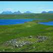
SC 851643 |
Digital image of Loch Vatachan (NC01SW 34); view of hut-circle from W |
15/6/1994 |
Item Level |
 |
On-line Digital Images |
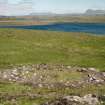
SC 919550 |
View of hut-circle from SW. |
15/6/1996 |
Item Level |
 |
On-line Digital Images |
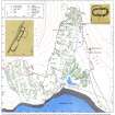
SC 370641 |
Plan of Badentarbat. Photographic copy. |
1997 |
Item Level |
 |
On-line Digital Images |
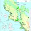
SC 2035274 |
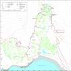
Map of the archaeology in the RCAHMS Achiltibuie survey area, 1994. Created for the RCAHMS broadsheet Achiltibuie - The Archaeology of a crofting landscape (WP003842.pdf)
|
1997 |
Item Level |
 |
On-line Digital Images |
SC 2035297 |
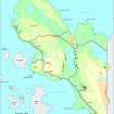
Plan of Badentarbat |
1997 |
Item Level |
 |
On-line Digital Images |
SC 2035304 |
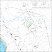
Map of the prehistoric archaeology in the RCAHMS Achiltibuie survey area, 1994. |
1997 |
Item Level |
 |
On-line Digital Images |
SC 2035306 |
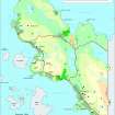
Map of the archaeology of Achiltibuie village and surrounding area |
1997 |
Item Level |
 |
On-line Digital Images |
SC 2035302 |
Map of the medieval or later archaeology in the RCAHMS Achiltibuie survey area, 1994. |
1997 |
Item Level |
 |
On-line Digital Images |
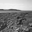
SC 2244712 |
Loch Poll an Dunain, Polglass, naust from NE |
10/5/1997 |
Item Level |
 |
On-line Digital Images |
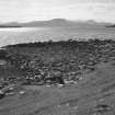
SC 2244713 |
Loch Poll an Dunain, Polglass, naust and slipway from N |
10/5/1997 |
Item Level |
 |
On-line Digital Images |
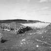
SC 2244714 |
Loch Poll an Dunain, Polglass, naust from NE |
10/5/1997 |
Item Level |
 |
On-line Digital Images |
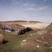
SC 2244715 |
Loch Poll an Dunain, Polglass, naust from NE |
10/5/1997 |
Item Level |
 |
On-line Digital Images |
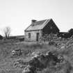
SC 2244716 |
Achlochan farmstead |
6/5/1997 |
Item Level |
 |
On-line Digital Images |
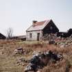
SC 2244717 |
Achlochan farmstead |
6/5/1997 |
Item Level |


