Accessibility

Font Size

100% 150% 200%

Background Colour

Default Contrast
Close Reset

Following the launch of trove.scot in February 2025 we are now planning the retiral of some of our webservices. Canmore will be switched off on 24th June 2025. Information about the closure can be found on the HES website: Retiral of HES web services | Historic Environment Scotland

Cuil, Appin

551 232/9

Description Cuil, Appin

Collection Scotland's Rural Past

Catalogue Number 551 232/9

Category All Other

Permalink http://canmore.org.uk/collection/1541064

Collection Hierarchy - Batch Level

Collection Level (551 232) Scotland's Rural Past

> Batch Level (551 232/9) Cuil, Appin

Preview Category Catalogue Number Title Date Level
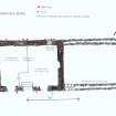
On-line Digital Images On-line Digital Images SC 1225226 Plan of Barn (Lowewr Level): 3 South Cuil. 1/12/2010 Item Level
On-line Digital Images On-line Digital Images DP 093758 Farmhouse: 3 South Cuil. 24/7/2009 Item Level
On-line Digital Images On-line Digital Images DP 093759 Double Byre Drain: Barn: 3 South Cuil. 16/9/2009 Item Level
On-line Digital Images On-line Digital Images SC 1225229 1871 ad 1897 Ordnance Survey Maps showing difference in distribution of buildings in region of 2 and 3 South Cuil. 1/12/2010 Item Level
On-line Digital Images On-line Digital Images DP 093760 Sandstone Blocks in South Cuil Burn. 4/3/2009 Item Level
On-line Digital Images On-line Digital Images DP 093762 Wall near Waterfall. 4/3/2009 Item Level
On-line Digital Images On-line Digital Images SC 1225235 House Platform: North Cuil 1/12/2010 Item Level
On-line Digital Images On-line Digital Images DP 093764 Corn Drying Kiln: Balnagowan Garden: North Cuil. 20/10/2010 Item Level
On-line Digital Images On-line Digital Images SC 1225237 Corn Dryinjg Kiln: Balnagowan Garden: North Cuil. 20/10/2010 Item Level
On-line Digital Images On-line Digital Images SC 1225238 Stackyard: Greenfield farm: North Cuil. 1/12/2010 Item Level
On-line Digital Images On-line Digital Images SC 1225239 Barn & Steading: Greenfield Farm: North Cuil 1/12/2010 Item Level
On-line Digital Images On-line Digital Images SC 1225240 Steading: Greenfield Farm: North Cuil 1/12/2010 Item Level
On-line Digital Images On-line Digital Images DP 093763 Double Flue: Steading: Greenfield Farm: North Cuil 25/9/2009 Item Level
On-line Digital Images On-line Digital Images DP 093765 Greenfield Farmhouse: North Cuil. 17/2/2010 Item Level
On-line Digital Images On-line Digital Images SC 1225244 Byre Dwelling: Greenfield Farm: North Cuil. 1/12/2010 Item Level
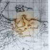
On-line Digital Images On-line Digital Images SC 1225245 Timothy Pont's Map: circa 1595. 1/12/2010 Item Level
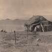
On-line Digital Images On-line Digital Images SC 1225246 1883 Erskine Beveridge Photograph: RCAHMS Collection. 1/2/2010 Item Level
On-line Digital Images On-line Digital Images SC 1225247 1952 photo of Bothy showing rounded inland corner. 1/2/2010 Item Level
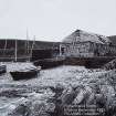
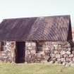
On-line Digital Images On-line Digital Images DP 093768 Bothy nowadays: note difference in building styles. 1/2/2010 Item Level
On-line Digital Images On-line Digital Images DP 093766 Greenfield Farmhouse: North Cuil. Survey plan 30/1/2011 Item Level
On-line Digital Images On-line Digital Images DP 093767 1883 Erskine Beveridge Photograph: RCAHMS Collection: Byre Dwelling and Barn at Greenfield Farm can be seen in the background. 1/12/2010 Item Level
On-line Digital Images On-line Digital Images SC 1225251 Erskine Beveridge Photograph: RCAHMS Collection: a line of seaweed can be seen right lower: 2 & 3 South Cuil can be seen in the background. 14/7/1883 Item Level
On-line Digital Images On-line Digital Images DP 093769 Line of boulders can be seen left centre and water pooling can also be seen. South Cuil in background. 19/3/2010 Item Level
On-line Digital Images On-line Digital Images SC 1225254 Plan of Fisherman's Bothy. 1/2/2010 Item Level

People and Organisations

Events