Accessibility

Font Size

100% 150% 200%

Background Colour

Default Contrast
Close Reset

Survey drawings

551 1/4/16/29/7/2

Description Survey drawings

Date 8/2008

Collection Records of the Royal Commission on the Ancient and Historical Monuments of Scotland (RCAHMS), Edinbu

Catalogue Number 551 1/4/16/29/7/2

Category All Other

Permalink http://canmore.org.uk/collection/1536324

Collection Hierarchy - Sub-Group Level

Preview Category Catalogue Number Title Date Level
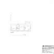
On-line Digital Images On-line Digital Images SC 1130758 RCAHMS survey drawing: ground plan of Kearvaig shepherd's cottage. 13/8/2008 Item Level
On-line Digital Images On-line Digital Images SC 1130762 RCAHMS survey drawing: ground plan of Kearvaig farmstead. 13/8/2008 Item Level
On-line Digital Images On-line Digital Images SC 1130772 RCAHMS survey drawing: ground plan of the house at Inshore. 13/8/2008 Item Level
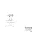
On-line Digital Images On-line Digital Images SC 1130773 RCAHMS survey drawing: plan and elevation of the bridge over the Allt na Guaille. 13/8/2008 Item Level
On-line Digital Images On-line Digital Images SC 1130744 RCAHMS survey drawing: plan and elevation of the bridge over Kearvaig River. 13/8/2008 Item Level
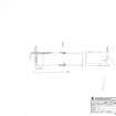
On-line Digital Images On-line Digital Images SC 1130745 RCAHMS survey drawing: plan of a building at Port Odhar. 13/8/2008 Item Level
On-line Digital Images On-line Digital Images SC 1130746 RCAHMS survey drawing: ground and first floor plans of the cottage at Inshore. 25/8/2008 Item Level
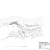
On-line Digital Images On-line Digital Images SC 1130748 RCAHMS survey drawing: site plan of the slipway at Clais Charnach 9/8/2008 Item Level
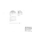
On-line Digital Images On-line Digital Images SC 1130752 RCAHMS survey drawing: plan, elevation and cross section of the storehouse building at Clais Charnach. 9/8/2008 Item Level
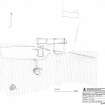
On-line Digital Images On-line Digital Images SC 1130757 RCAHMS survey drawing: site plan of Kearvaig farmstead and shepherd's cottage. 12/8/2008 Item Level
Prints and Drawings DC 49383 RCAHMS survey drawing: Ground plan of shieling group 9/8/2008 Item Level
Prints and Drawings DC 49384 RCAHMS survey drawing: Site plan of Clais Charnach slipway 9/8/2008 Item Level
Prints and Drawings DC 49385 RCAHMS survey drawing: Ground plan, elevation and section of Clais Charnach storehouse 9/8/2008 Item Level
Prints and Drawings DC 49386 RCAHMS survey drawing: Site plan of Kearvaig farmstead and shepherd's house. 12/8/2008 Item Level
Prints and Drawings DC 49387 RCAHMS survey drawing: Ground plan of Kearvaig farmhouse. 13/8/2008 Item Level
Prints and Drawings DC 49388 RCAHMS survey drawing: Ground plan of Kearvaig farmstead. 13/8/2008 Item Level
Prints and Drawings DC 49389 RCAHMS survey drawing: Ground plan and elevation of the bridge crossing Kervaig river 13/8/2008 Item Level
Prints and Drawings DC 49390 RCAHMS survey drawing: Plan of building at Port Odhar 13/8/2008 Item Level
Prints and Drawings DC 49391 RCAHMS survey drawing: Ground-floor plan and first-floor plan of the cottage at Inshore 25/8/2008 Item Level
Prints and Drawings DC 49392 RCAHMS survey drawing: Ground-floor plan of the house at Inshore 13/8/2008 Item Level
Prints and Drawings DC 49393 RCAHMS survey drawing: Ground plan and elevation of the bridge at Allt na Guaille 13/8/2008 Item Level

People and Organisations

Events