|
All Other |
551 500/1/8/2/6/1/1 |
UAV Photography |
4/10/2017 |
Batch Level |
 |
Digital Files (Non-image) |
WP 008076 |
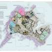
Easdale survey maps |
9/4/2020 |
Item Level |
 |
Digital Files (Non-image) |
WP 008070 |
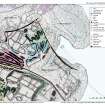
North east Easdale Survey Map: slate debris dumping and enclosures to west of Harbour area and to east to Windmill Quarry |
2018 |
Item Level |
 |
Digital Files (Non-image) |
WP 008073 |
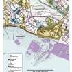
South west/ south central Easdale Survey Map: Klondyke Quarry to the north, agricultural enclosures (abandoned) and early coastal quarries to south |
2018 |
Item Level |
 |
On-line Digital Images |
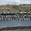
DP 232612 |
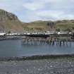
Disused pier and Ellenabeich, general view from south west |
21/3/2016 |
Item Level |
 |
On-line Digital Images |
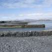
DP 232613 |
Disused pier, view from south west |
21/3/2016 |
Item Level |
 |
On-line Digital Images |
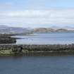
DP 232614 |
Breakwaters to north east of village, view from south east |
21/3/2016 |
Item Level |
 |
On-line Digital Images |
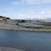
DP 232615 |
Breakwaters to north east of village, view from south east |
21/3/2016 |
Item Level |
 |
On-line Digital Images |
DP 232616 |
Breakwaters to north east of village, view from east |
21/3/2016 |
Item Level |
 |
On-line Digital Images |
DP 232617 |
Breakwaters to north east of village, view from south east |
21/3/2016 |
Item Level |
 |
On-line Digital Images |
DP 232618 |
Slipway, disused pier and Ellenabeich, view from south west |
21/3/2016 |
Item Level |
 |
On-line Digital Images |
DP 232619 |
Ellenabeich, general view from south west |
21/3/2016 |
Item Level |
 |
On-line Digital Images |
DP 232620 |
Ellenabeich, view from south west |
21/3/2016 |
Item Level |
 |
On-line Digital Images |
DP 232621 |
Disused pier, view from south west |
21/3/2016 |
Item Level |
 |
On-line Digital Images |
DP 232622 |
Disused pier, view from south west |
21/3/2016 |
Item Level |
 |
On-line Digital Images |
DP 232623 |
South garden enclosures centred on NM73630 17002, view from west |
21/3/2016 |
Item Level |
 |
On-line Digital Images |
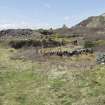
DP 232625 |
South garden enclosures and slate spoil, view from west. Garden enclosure centre at NM73624 17001 and (right) at NM73639 16991 |
21/3/2016 |
Item Level |
 |
On-line Digital Images |
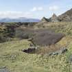
DP 232630 |
Track and south garden enclosures, at NMS73632 16994, view from south east |
21/3/2016 |
Item Level |
 |
On-line Digital Images |
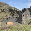
DP 232633 |
South garden enclosures around NM73630 17002, view from south |
21/3/2016 |
Item Level |
 |
On-line Digital Images |
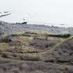
DP 232637 |
Boiler house, view from west. The Klondyke Quarry (NM71NW 120/ Canmore ID: 353998) sits behind it. |
21/3/2016 |
Item Level |
 |
On-line Digital Images |
DP 232640 |
South garden enclosures centred at NM73630 16997, view from high ground to north |
21/3/2016 |
Item Level |
 |
On-line Digital Images |
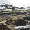
DP 232645 |
West end of island, view from high ground to north east |
21/3/2016 |
Item Level |
 |
On-line Digital Images |
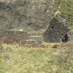
DP 232648 |
Building to north of boiler house, view from west |
21/3/2016 |
Item Level |
 |
On-line Digital Images |
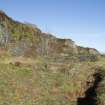
DP 232650 |
Central garden enclosures at NM73728 17068 and NM73719 17084, to west of main track, view from south (spoil at NM73700 17083) |
21/3/2016 |
Item Level |


