 |
On-line Digital Images |
SC 1123653 |
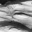
Oblique aerial view of 'Maiden Castle'. |
26/11/1930 |
Item Level |
 |
On-line Digital Images |
SC 1122344 |
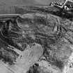
Oblique aerial view of fort.
Published in RCAHMS Fife Inventory, figure 10.
|
22/3/1932 |
Item Level |
 |
On-line Digital Images |
SC 1740680 |
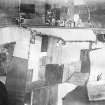
Vertical aerial view of Mungoswells showing the cropmarks of a fort and a possible enclosure. |
c. 1930 |
Item Level |
 |
On-line Digital Images |
SC 1740681 |
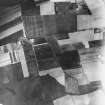
Vertical aerial view of Mungoswells showing the cropmarks of a fort and two possible ring-ditches. |
c. 1930 |
Item Level |
 |
On-line Digital Images |
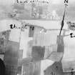
SC 1740682 |
Vertical aerial view of Mungoswells showing the cropmarks of a fort. |
c. 1930 |
Item Level |
 |
On-line Digital Images |
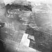
SC 1744702 |
Vertical aerial view of The Chesters, Drem showing the fort and a pit-alignment. |
c. 1930 |
Item Level |
 |
On-line Digital Images |
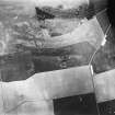
SC 1744417 |
Vertical aerial view of The Chesters, Drem showing the fort, a circular palisaded settlement and the W end of a settlement. |
c. 1930 |
Item Level |
 |
On-line Digital Images |
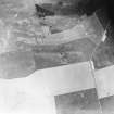
SC 1744418 |
Vertical aerial view of The Chesters, Drem showing the fort, a circular palisaded settlement, a pit-alignment and the W end of a settlement. |
c. 1930 |
Item Level |
 |
On-line Digital Images |
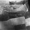
SC 1744419 |
Vertical aerial view of The Chesters, Drem showing the fort, a circular palisaded settlement and a pit-alignment. |
c. 1930 |
Item Level |
 |
On-line Digital Images |
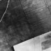
SC 1744255 |
Vertical aerial view of Sixpence Strip centred on a circular palisaded settlement. |
c. 1930 |
Item Level |
|
Manuscripts |
MS 598/2 |
Letter from Wing Commander Insall to W M McKenzie February 6th 1932 concerning sites in Fife. |
6/2/1932 |
Item Level |
|
Manuscripts |
MS 598/3 |
Letter from Wing Commander Insall, August 28th concerning sites in Lanarkshire |
1930 |
Item Level |
|
Manuscripts |
MS 598/1 |
Letter from Wing Commander Insall to J G Callander, December 2nd 1930 concerning sites around Crichton. |
1930 |
Item Level |
|
Photographs and Off-line Digital Images |
D 16299 |
Oblique aerial view of Birky Bank centred on cropmarks in a field to the ESE of Crichton Castle, taken from the SE. |
c. 1930 |
Item Level |
|
Photographs and Off-line Digital Images |
D 16301 |
Oblique aerial view of Birky Bank centred on cropmarks in a field to the ESE of Crichton Castle, taken from the SE. |
c. 1930 |
Item Level |
|
Photographs and Off-line Digital Images |
D 16303 |
Oblique aerial view of Birky Bank centred on cropmarks in a field to the ESE of Crichton Castle, taken from the SE. |
c. 1930 |
Item Level |
|
Photographs and Off-line Digital Images |
D 16300 |
Oblique aerial view of Birky Bank centred on cropmarks in a field to the ESE of Crichton Castle, taken from the WSW. |
c. 1930 |
Item Level |
|
Photographs and Off-line Digital Images |
D 16302 |
Oblique aerial view of Birky Bank centred on cropmarks in a field to the ESE of Crichton Castle, taken from the N. |
c. 1930 |
Item Level |
|
Photographs and Off-line Digital Images |
D 16304 |
Oblique aerial view of Birky Bank centred on cropmarks in a field to the ESE of Crichton Castle, taken from the SSW. |
c. 1930 |
Item Level |
|
Photographs and Off-line Digital Images |
D 16305 |
Oblique aerial view of Birky Bank centred on cropmarks in a field to the ESE of Crichton Castle, taken from the SSE. |
c. 1930 |
Item Level |
|
Photographs and Off-line Digital Images |
D 16306 |
Oblique aerial view of Crichton centred on the cropmarks of a settlement, taken from the SW. |
c. 1930 |
Item Level |
|
Photographs and Off-line Digital Images |
D 16307 |
Oblique aerial view of Longfaugh centred on the cropmarks of enclosures, taken from the SE. |
c. 1930 |
Item Level |
|
Photographs and Off-line Digital Images |
D 16308 |
Oblique aerial view of Longfaugh centred on the cropmarks of enclosures, taken from the ENE. |
c. 1930 |
Item Level |
|
Photographs and Off-line Digital Images |
E 21522 |
Vertical aerial view of The Chesters, Drem showing the fort, a circular palisaded settlement and a pit-alignment. |
c. 1930 |
Item Level |


