|
Digital Files (Non-image) |
GV 006053 |
Map showing the locations of the five forts, illustration 1 from a report on a topographic archaeological survey at five Pictish Forts in the Highlands |
9/2010 |
Item Level |
|
Digital Files (Non-image) |
GV 006054 |
Plan of Caisteal Mac Tuathal at 1:750, illustration 13 from a report on a topographic archaeological survey at five Pictish Forts in the Highlands |
9/2010 |
Item Level |
|
Digital Files (Non-image) |
GV 006055 |
Plan of Dun da Lamh at 1:500, illustration 14 from a report on a topographic archaeological survey at five Pictish Forts in the Highlands |
9/2010 |
Item Level |
|
Digital Files (Non-image) |
GV 006056 |
Plan of Dun Deadrail at 1:250, illustration 15 from a report on a topographic archaeological survey at five Pictish Forts in the Highlands |
9/2010 |
Item Level |
|
Digital Files (Non-image) |
GV 006057 |
Plan of Torr Dhuin at 1:250, illustration 16 from a report on a topographic archaeological survey at five Pictish Forts in the Highlands |
9/2010 |
Item Level |
|
Digital Files (Non-image) |
GV 006058 |
Plan of Craig Phadrig at 1:500, illustration 17 from a report on a topographic archaeological survey at five Pictish Forts in the Highlands |
9/2010 |
Item Level |
 |
On-line Digital Images |
DP 230712 |
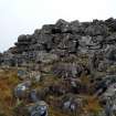
Caisteal Mac Tuathal, external rampart face at south-west corner, photo taken September 2010, illustration 2 from a report on a topographic archaeological survey at five Pictish Forts in the Highlands |
9/2010 |
Item Level |
 |
On-line Digital Images |
DP 230713 |
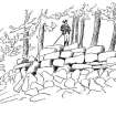
19th century sketch of Caisteal Mac Tuathal, illustration 2a from a report on a topographic archaeological survey at five Pictish Forts in the Highlands |
9/2010 |
Item Level |
 |
On-line Digital Images |
DP 230714 |
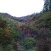
Caisteal Mac Tuathal, defensive ditch to the south of the fort, illustration 3 from a report on a topographic archaeological survey at five Pictish Forts in the Highlands |
9/2010 |
Item Level |
 |
On-line Digital Images |
DP 230715 |
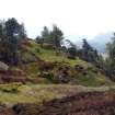
Dun da Lamh, east-facing view of interior, illustration 4 from a report on a topographic archaeological survey at five Pictish Forts in the Highlands |
9/2010 |
Item Level |
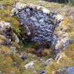 |
On-line Digital Images |
DP 230716 |
Dun da Lamh, inner rampart face exposed at north-west corner, illustration 5 from a report on a topographic archaeological survey at five Pictish Forts in the Highlands |
9/2010 |
Item Level |
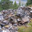 |
On-line Digital Images |
DP 230717 |
Dun da Lamh, shelter possibly associated with World War II lookout, illustration 6 from a report on a topographic archaeological survey at five Pictish Forts in the Highlands |
9/2010 |
Item Level |
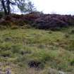 |
On-line Digital Images |
DP 230718 |
Dun da Lamh, possible hut-platform inside the north rampart, illustration 7 from a report on a topographic archaeological survey at five Pictish Forts in the Highlands |
9/2010 |
Item Level |
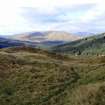 |
On-line Digital Images |
DP 230719 |
Dun Deadrail, west-facing view of interior, illustration 8 from a report on a topographic archaeological survey at five Pictish Forts in the Highlands |
9/2010 |
Item Level |
 |
On-line Digital Images |
DP 230720 |
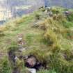
Dun Deadrail, slight erosion on top of north rampart, illustration 9 from a report on a topographic archaeological survey at five Pictish Forts in the Highlands |
9/2010 |
Item Level |
 |
On-line Digital Images |
DP 230722 |
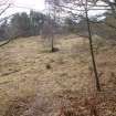
Craig Phadrig, south-west facing view of interior, illustration 11 from a report on a topographic archaeological survey at five Pictish Forts in the Highlands |
9/2010 |
Item Level |
 |
On-line Digital Images |
DP 230723 |
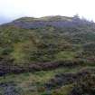
View of Caisteal Mac Tuathal from high ground to the south-west, illustration 12 from a report on a topographic archaeological survey at five Pictish Forts in the Highlands |
9/2010 |
Item Level |


