|
Digital Files (Non-image) |
GV 008644 |
Map of Easdale Island showing the mapping and phasing of the HES survey, quarrying activity, tipping, internal transport and garden enclosures. |
10/2019 |
Item Level |
|
Digital Files (Non-image) |
WP 007588 |
Layered interactive PDF map of south Easdale Island, Camus Mor area, showing HES survey of the south quarries including spoil, walls and workings. |
10/2019 |
Item Level |
|
Digital Files (Non-image) |
GV 008650 |
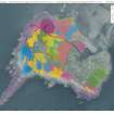
Map of Easdale Island showing HES phasing survey |
10/2019 |
Item Level |
 |
Digital Files (Non-image) |
WP 007589 |
PDF report - Slate Quarrying Landscape, Easdale Island, Lorn, Argyll and Bute
|
5/2021 |
Item Level |
|
Digital Files (Non-image) |
GV 008648 |
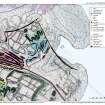
Map of north-east corner of Easdale Island showing HES survey, including North spoil, walls and workings. |
10/2019 |
Item Level |
 |
Digital Files (Non-image) |
WP 007586 |
Layered interactive PDF map of Easdale Island showing HES phasing survey |
10/2019 |
Item Level |
 |
Digital Files (Non-image) |
WP 007585 |
Layered interactive PDF map of north-east corner of Easdale Island showing HES survey, including North spoil, walls and workings. |
10/2019 |
Item Level |
|
Digital Files (Non-image) |
GV 008651 |
Map of Easdale Island showing HES survey of quarries, tramways and slate distribution. |
10/2019 |
Item Level |
|
Digital Files (Non-image) |
GV 008653 |
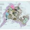
Map of south Easdale Island, Camus Mor area, showing HES survey of the south quarries including spoil, walls and workings. |
10/2019 |
Item Level |
 |
Digital Files (Non-image) |
WP 007584 |
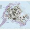
Layered interactive PDF of Easdale Island showing the mapping and phasing of the HES survey, quarrying activity, tipping, internal transport and garden enclosures. |
10/2019 |
Item Level |
 |
Digital Files (Non-image) |
WP 007587 |
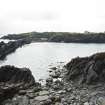
Layered interactive PDF map of Easdale Island showing HES survey of quarries, tramways and slate distribution. |
10/2019 |
Item Level |
 |
On-line Digital Images |
DP 228154 |
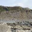
Midd Engine Quarry, view from east |
7/9/2015 |
Item Level |
 |
On-line Digital Images |
DP 228178 |
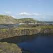
Slate mound at south of island (centred at NM73710 16983), view of revetting walling from south designed to stabilise the slate waste. |
7/9/2015 |
Item Level |
 |
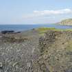
On-line Digital Images |
DP 228084 |
Causeway and Creag Nam Duin quarry (NM71NW 115), general view from west |
7/9/2015 |
Item Level |
 |
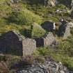
On-line Digital Images |
DP 228085 |
Area to north west of Creag Nam Duin quarry (NM71NW 115), section of walling at NM73549 17272, view from south |
7/9/2015 |
Item Level |
 |
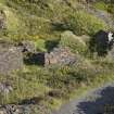
On-line Digital Images |
DP 228087 |
Ruinous building (The Forge, NM17NW 132) to east of quarry NM71NW 116, view from north west. The two compartments and the vegetation covered hearth or forge are visible |
7/9/2015 |
Item Level |
 |
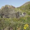
On-line Digital Images |
DP 228088 |
Ruinous building to east of quarry NM71NW 116, view from south west |
7/9/2015 |
Item Level |
 |
On-line Digital Images |
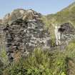
DP 228090 |
Ruinous building to east of quarry NM71NW 116, view from south |
7/9/2015 |
Item Level |
 |
On-line Digital Images |
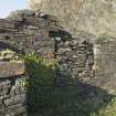
DP 228091 |
Ruinous building to east of quarry NM71NW 116, view of exterior of gable with window opening |
7/9/2015 |
Item Level |
 |
On-line Digital Images |
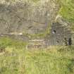
DP 228093 |
Ruinous building to east of quarry NM71NW 116, view of gable with blocked opening |
7/9/2015 |
Item Level |
 |
On-line Digital Images |
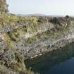
DP 228094 |
Ruinous building to east of quarry NM71NW 116, view from west |
7/9/2015 |
Item Level |
 |
On-line Digital Images |
DP 228096 |
Quarry NM71NW 117, view of walling on south side showing former tramway route above. |
7/9/2015 |
Item Level |
 |
On-line Digital Images |
DP 228098 |
Quarry NM71NW 117, view from west |
7/9/2015 |
Item Level |
 |
On-line Digital Images |
DP 228100 |
Quarry NM71NW 117, view from north west |
7/9/2015 |
Item Level |


