551 500/1/1/1/1
Description Sortie 2015/45
Date 17/11/2015
Collection Historic Environment Scotland
Catalogue Number 551 500/1/1/1/1
Category All Other
Permalink http://canmore.org.uk/collection/1498798
Collection Hierarchy - Sub-Group Level
Collection Level (551 500) Historic Environment Scotland
> Group Level (551 500/1) Survey and Recording Programmes
>> Sub-Group Level (551 500/1/1) Aerial Survey Programme
>>> Sub-Group Level (551 500/1/1/1) 2015 photographs
>>>> Sub-Group Level (551 500/1/1/1/1) Sortie 2015/45
| Preview | Category | Catalogue Number | Title | Date | Level |
|---|---|---|---|---|---|
| Digital Files (Non-image) | TM 000758 | GPS recorded flight path and map for Sortie 2015/45 | 17/11/2015 | Item Level | |
 |
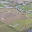
On-line Digital Images | DP 226638 | General oblique aerial view of the flooding along the River Isla at the Bridge of Crathies with Meigle in the distance, looking SSE. | 17/11/2015 | Item Level |
 |
On-line Digital Images | DP 226639 | General oblique aerial view of the flooding along the River Isla, looking WSW. | 17/11/2015 | Item Level |
 |
On-line Digital Images | DP 226640 | General oblique aerial view of the flooding along the River Isla with Balmyle in the distance, looking SSE. | 17/11/2015 | Item Level |
 |
On-line Digital Images | DP 226641 | Oblique aerial view of the archaeological evaluation trenches fringing the scheduled area at Leys of Marlee, looking SE. | 17/11/2015 | Item Level |
 |
On-line Digital Images | DP 226642 | Oblique aerial view of the archaeological evaluation trenches fringing the scheduled area at Leys of Marlee, looking ESE. | 17/11/2015 | Item Level |
 |
On-line Digital Images | DP 226643 | Oblique aerial view of the cairn, looking SE. | 17/11/2015 | Item Level |
 |
On-line Digital Images | DP 226644 | General oblique aerial view of the flooding along the River Earn, looking W. | 17/11/2015 | Item Level |
 |
On-line Digital Images | DP 226645 | General oblique aerial view of the flooding along the River Earn at Masterfield, looking NW. | 17/11/2015 | Item Level |
 |
On-line Digital Images | DP 226646 | General oblique aerial view of the flooding along the River Earn at the Broom of Dalreoch, looking W. | 17/11/2015 | Item Level |
 |
On-line Digital Images | DP 226647 | General oblique aerial view of the flooding along the River Earn at Masterfield, looking WSW. | 17/11/2015 | Item Level |
 |
On-line Digital Images | DP 226649 | General oblique aerial view of the flooding along the River Earn at the Broom of Dalreoch, looking SSE. | 17/11/2015 | Item Level |
 |
On-line Digital Images | DP 226651 | Oblique aerial view of the site of T in the Park at Strathallan, looking E. | 17/11/2015 | Item Level |
 |
On-line Digital Images | DP 226653 | Oblique aerial view of the flooding at the site of the possible timber hall at Dalpatrick, looking SSW. | 17/11/2015 | Item Level |
 |
On-line Digital Images | DP 226656 | Oblique aerial view of the submerged remains of the veterans settlement in the Pool of Drummond, looking ESE. | 17/11/2015 | Item Level |
 |
On-line Digital Images | DP 226659 | Oblique aerial view of the line of the enclosure ditch visible in stubble, looking NNW. | 17/11/2015 | Item Level |
 |
On-line Digital Images | DP 226661 | Oblique aerial view of the line of the enclosure ditch visible in stubble, looking SSE. | 17/11/2015 | Item Level |
 |
On-line Digital Images | DP 226648 | General oblique aerial view of the flooding along the River Earn at Masterfield, looking SSW. | 17/11/2015 | Item Level |
 |
On-line Digital Images | DP 226650 | Oblique aerial view of the site of T in the Park at Strathallan, looking S. | 17/11/2015 | Item Level |
 |
On-line Digital Images | DP 226652 | Oblique aerial view of Innerpeffray Castle, looking SSW. | 17/11/2015 | Item Level |
 |
On-line Digital Images | DP 226654 | Oblique aerial view of the submerged remains of the veterans settlement in the Pool of Drummond, looking NW. | 17/11/2015 | Item Level |
 |
On-line Digital Images | DP 226655 | Oblique aerial view of the submerged remains of the veterans settlement in the Pool of Drummond, looking WNW. | 17/11/2015 | Item Level |
 |
On-line Digital Images | DP 226657 | Oblique aerial view of the submerged remains of the veterans settlement in the Pool of Drummond, looking N. | 17/11/2015 | Item Level |
 |
On-line Digital Images | DP 226658 | General oblique aerial view of the flooding along the River Earn with Perth in the distance, looking NE. | 17/11/2015 | Item Level |


