 |
On-line Digital Images |
SC 1716861 |
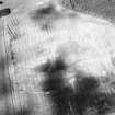
Survey photograph : site 69 - boundary dyke, length 1100m composed of earth, turf and stone, enclosing land holdings. |
1983 |
Item Level |
 |
On-line Digital Images |
SC 1716862 |
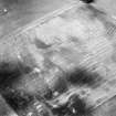
Survey photograph : site 35 - Muckle House - comprising four structures, some domestic, some agricultural/storage. |
1983 |
Item Level |
 |
On-line Digital Images |
SC 1716863 |
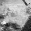
Survey photograph : site 35a - latest domestic structure of single room, wooden partition. |
1983 |
Item Level |
 |
On-line Digital Images |
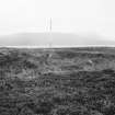
SC 1894158 |
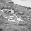
Survey photograph : remains of stone walled structure. |
1983 |
Item Level |
 |
On-line Digital Images |
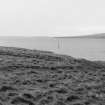
SC 1894159 |
Survey photograph : sub-rectangular earthwork with some stones in centre. |
1983 |
Item Level |
 |
On-line Digital Images |
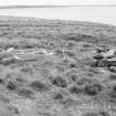
SC 1894160 |
Survey photograph : site 24 - remains of turf covered rectangular stone structure formed in two cells, divided by an inner wall. |
1983 |
Item Level |
 |
On-line Digital Images |
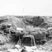
SC 1894161 |
Survey photograph : site 25 - remains of two rectangular stone structures, both of drystone construction and faced on both sides. |
1983 |
Item Level |
 |
On-line Digital Images |
SC 1894162 |
Survey photograph : site 26 - boat naust, eroded at seaward end, partially stone revetted on both sides. |
1983 |
Item Level |
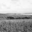 |
On-line Digital Images |
SC 1894163 |
Survey photograph : View looking south-east, towards site 27, 'North House'. |
1983 |
Item Level |
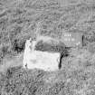 |
On-line Digital Images |
SC 1894164 |
Survey photograph : site 29 - large flat stone, possibly fallen. |
1983 |
Item Level |
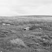 |
On-line Digital Images |
SC 1894165 |
Survey photograph : site 30 - U-shaped earthwork, banking composed of earth and turf. |
1983 |
Item Level |
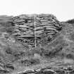 |
On-line Digital Images |
SC 1894166 |
Survey photograph : site 31 - natural cleft in cliff face, blocked at sea face by drystone walling, with corrugated iron and timbers - possible Anderson shelter. |
1983 |
Item Level |
 |
On-line Digital Images |
SC 1894167 |
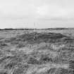
Survey photograph : site 33 - low turf-covered mound with possible ditch and bank surrounding. |
1983 |
Item Level |
 |
On-line Digital Images |
SC 1894168 |
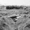
Survey photograph : site 34 - stone bridge over ditch, drystone coursing. |
1983 |
Item Level |
 |
On-line Digital Images |
SC 1894169 |
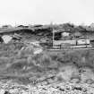
Survey photograph : site 35f - Muckle House - associated features - length of eroded shore section, 20m south of stone steps, showing large slabbed stones underlying five parallel concrete piers. |
1983 |
Item Level |
 |
On-line Digital Images |
SC 1894170 |
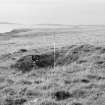
Survey photograph : site 43 - irregular L-shaped dugout, with banking predominantly surviving on coastal side; large number of pits in surrounding area. |
1983 |
Item Level |
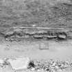 |
On-line Digital Images |
SC 1894171 |
Survey photograph : site 40 - eroded length of low cliff section, with flagstones and ash debris. |
1983 |
Item Level |
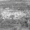 |
On-line Digital Images |
SC 1894172 |
Survey photograph : site 58 - low mound of small stones. |
1983 |
Item Level |
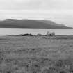 |
On-line Digital Images |
SC 1894173 |
Survey photograph : site 35 - Muckle House comprising four structures, some domestic, some agricultural/storage. |
1983 |
Item Level |
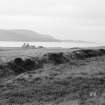 |
On-line Digital Images |
SC 1894174 |
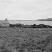
Survey photograph : site 69 - boundary dyke, length 1100m composed of earth, turf and stone, enclosing land holdings. |
1983 |
Item Level |
 |
On-line Digital Images |
SC 1894175 |
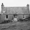
Survey photograph : site 35 - Muckle House - comprising four structures, some domestic, some agricultural/storage. |
1983 |
Item Level |
 |
On-line Digital Images |
SC 1894176 |
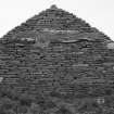
Survey photograph : site 35a - latest domestic structure of single room, wooden partition. |
1983 |
Item Level |
 |
On-line Digital Images |
SC 1894177 |
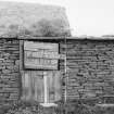
Survey photograph : site 35b - agricultural/storage unit, with small sub-structure at east end. Drystone construction, partially surviving turf roof. |
1983 |
Item Level |
 |
On-line Digital Images |
SC 1894178 |
Survey photograph : site 35b - agricultural/storage unit, with small sub-structure at east end. Drystone construction, partially surviving turf roof. |
1983 |
Item Level |


