Sortie 2015/25
551 178/2019/22
Description Sortie 2015/25
Date 9/7/2015
Collection RCAHMS Aerial Photography Digital
Catalogue Number 551 178/2019/22
Category All Other
Permalink http://canmore.org.uk/collection/1482382
Description Sortie 2015/25
Date 9/7/2015
Collection RCAHMS Aerial Photography Digital
Catalogue Number 551 178/2019/22
Category All Other
Permalink http://canmore.org.uk/collection/1482382
Collection Level (551 178) RCAHMS Aerial Photography Digital
> Group Level (551 178/2019) 2015 Photographs
>> Sub-Group Level (551 178/2019/22) Sortie 2015/25
| Preview | Category | Catalogue Number | Title | Date | Level |
|---|---|---|---|---|---|
| Digital Files (Non-image) | TM 000737 | GPS recorded flight path and map for Sortie 2015/25 | 9/7/2015 | Item Level | |
 |
On-line Digital Images | DP 216664 | Oblique aerial view centred on the ploughed out remains of the reverse S-shaped field boundaries, looking N. | 9/7/2015 | Item Level |
 |
On-line Digital Images | DP 216665 | Oblique aerial view centred on the ploughed out remains of the reverse S-shaped field boundaries, looking NNW. | 9/7/2015 | Item Level |
 |
On-line Digital Images | DP 216666 | Oblique aerial view centred on the ploughed out remains of the reverse S-shaped field boundaries, looking NNW. | 9/7/2015 | Item Level |
 |
On-line Digital Images | DP 216667 | Oblique aerial view centred on the ploughed out remains of the reverse S-shaped field boundaries, looking NNW. | 9/7/2015 | Item Level |
 |
On-line Digital Images | DP 216668 | Oblique aerial view centred on the ploughed out remains of the reverse S-shaped field boundaries, looking NNW. | 9/7/2015 | Item Level |
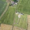 |
On-line Digital Images | DP 216670 | Oblique aerial view of the cropmarks of the field boundaries, looking WSW. | 9/7/2015 | Item Level |
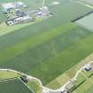 |
On-line Digital Images | DP 216672 | Oblique aerial view of the cropmarks of the palisaded enclosure, ring ditch and pit-defined boundary, looking ESE. | 9/7/2015 | Item Level |
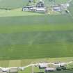 |
On-line Digital Images | DP 216674 | Oblique aerial view of the cropmarks of the palisaded enclosure, ring ditch and pit-defined boundary, looking ENE. | 9/7/2015 | Item Level |
 |
On-line Digital Images | DP 216675 | Oblique aerial view of the cropmarks of the pit-defined boundary, looking ENE. | 9/7/2015 | Item Level |
 |
On-line Digital Images | DP 216677 | Oblique aerial view of the cropmarks of the palisaded enclosure, looking SW. | 9/7/2015 | Item Level |
 |
On-line Digital Images | DP 216679 | Oblique aerial view of the cropmarks of the pit-defined boundary, looking SSE. | 9/7/2015 | Item Level |
 |
On-line Digital Images | DP 216682 | Oblique aerial view of the cropmarks of the rail track and colliery remains, looking SSE. | 9/7/2015 | Item Level |
 |
On-line Digital Images | DP 216684 | Oblique aerial view of the cropmarks of the settlement, looking SSE. | 9/7/2015 | Item Level |
 |
On-line Digital Images | DP 216686 | Oblique aerial view of the cropmarks of the settlement, looking SE. | 9/7/2015 | Item Level |
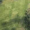 |
On-line Digital Images | DP 216689 | Oblique aerial view of the cropmarks of the enclosure and the pit-defined boundary system, looking W. | 9/7/2015 | Item Level |
 |
On-line Digital Images | DP 216690 | Oblique aerial view of the cropmarks of the enclosure and the pit-defined boundary system, looking WSW. | 9/7/2015 | Item Level |
 |
On-line Digital Images | DP 216691 | Oblique aerial view of the cropmarks of the pit-defined boundary system, looking SW. | 9/7/2015 | Item Level |
 |
On-line Digital Images | DP 216692 | Oblique aerial view of the cropmarks of the pit-defined boundary system, looking E. | 9/7/2015 | Item Level |
 |
On-line Digital Images | DP 216693 | Oblique aerial view of the cropmarks of the pit-defined boundary system, looking E. | 9/7/2015 | Item Level |
 |
On-line Digital Images | DP 216694 | Oblique aerial view of the cropmarks of the pit-defined boundary system, looking ENE. | 9/7/2015 | Item Level |
 |
On-line Digital Images | DP 216695 | Oblique aerial view of the cropmarks of the pit-defined boundary system, looking ENE. | 9/7/2015 | Item Level |
 |
On-line Digital Images | DP 216696 | Oblique aerial view of the cropmarks of the enclosure and pit-defined boundary system with the remains of the fort beyond, looking N. | 9/7/2015 | Item Level |
 |
On-line Digital Images | DP 216697 | Oblique aerial view of the cropmarks of the ring ditch, looking E. | 9/7/2015 | Item Level |

© Historic Environment Scotland. Scottish Charity No. SC045925