Sortie 2015/22
551 178/2019/19
Description Sortie 2015/22
Date 18/6/2015
Collection RCAHMS Aerial Photography Digital
Catalogue Number 551 178/2019/19
Category All Other
Permalink http://canmore.org.uk/collection/1480595
We use cookies to improve your experience on our site and show you personalised advertising.
Find out more from our privacy notice and cookie policy.
Your optionsDescription Sortie 2015/22
Date 18/6/2015
Collection RCAHMS Aerial Photography Digital
Catalogue Number 551 178/2019/19
Category All Other
Permalink http://canmore.org.uk/collection/1480595
Collection Level (551 178) RCAHMS Aerial Photography Digital
> Group Level (551 178/2019) 2015 Photographs
>> Sub-Group Level (551 178/2019/19) Sortie 2015/22
| Preview | Category | Catalogue Number | Title | Date | Level |
|---|---|---|---|---|---|
| Digital Files (Non-image) | TM 000734 | GPS recorded flight path and map for Sortie 2015/22 | 18/6/2015 | Item Level | |
 |
On-line Digital Images | DP 215272 | Oblique aerial view of the cropmarks of the possible ring ditch, looking SSE. | 18/6/2015 | Item Level |
 |
On-line Digital Images | DP 215273 | Oblique aerial view of the cropmarks of the possible ring ditch, looking ESE. | 18/6/2015 | Item Level |
 |
On-line Digital Images | DP 215274 | Oblique aerial view of the cropmarks of the possible ring ditch, looking NE, Invereil House | 18/6/2015 | Item Level |
 |
On-line Digital Images | DP 215275 | Oblique aerial view of the cropmarks of the possible ring ditch, looking WSW. | 18/6/2015 | Item Level |
 |
On-line Digital Images | DP 215276 | Oblique aerial view of the cropmarks of the possible sunken floored buildings, looking E. | 18/6/2015 | Item Level |
 |
On-line Digital Images | DP 215277 | Oblique aerial view of the cropmarks of the possible sunken floored buildings, looking ENE. | 18/6/2015 | Item Level |
 |
On-line Digital Images | DP 215278 | Oblique aerial view of the cropmarks of the possible sunken floored buildings, looking NE. | 18/6/2015 | Item Level |
 |
On-line Digital Images | DP 215279 | Oblique aerial view of the cropmarks of the pit alignment, looking SSE. | 18/6/2015 | Item Level |
 |
On-line Digital Images | DP 215280 | Oblique aerial view of the cropmarks of the pit alignment, looking E. | 18/6/2015 | Item Level |
 |
On-line Digital Images | DP 215282 | General oblique aerial view of the cropmarks of the pit alignment, looking N. | 18/6/2015 | Item Level |
 |
On-line Digital Images | DP 215284 | Oblique aerial view of the parkmarks of the plantation bank, looking ENE. | 18/6/2015 | Item Level |
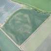 |
On-line Digital Images | DP 215288 | Oblique aerial view of the cropmarks of the ring ditch, looking ESE. | 18/6/2015 | Item Level |
 |
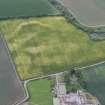
On-line Digital Images | DP 215290 | Oblique aerial view of the cropmarks of the settlement at Knowes, looking NE. | 18/6/2015 | Item Level |
 |
On-line Digital Images | DP 215292 | Oblique aerial view of the cropmarks of the Preston Mains cursus, looking S. | 18/6/2015 | Item Level |
 |
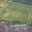
On-line Digital Images | DP 215293 | Oblique aerial view of the cropmarks of the field boundary, looking NW. | 18/6/2015 | Item Level |
 |
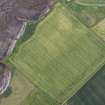
On-line Digital Images | DP 215295 | Oblique aerial view of the cropmarks of the enclosure and the site of Seacliff Tower, looking WSW. | 18/6/2015 | Item Level |
 |
On-line Digital Images | DP 215296 | Oblique aerial view of the cropmarks of the enclosure and the site of Seacliff Tower, looking ESE. | 18/6/2015 | Item Level |
 |
On-line Digital Images | DP 215297 | Oblique aerial view of the cropmarks of the enclosure and the site of Seacliff Tower, looking E. | 18/6/2015 | Item Level |
 |
On-line Digital Images | DP 215298 | Oblique aerial view of the cropmarks of the enclosure and the site of Seacliff Tower, looking ENE. | 18/6/2015 | Item Level |
 |
On-line Digital Images | DP 215299 | Oblique aerial view of the cropmarks of the enclosure and the site of Seacliff Tower, looking NE. | 18/6/2015 | Item Level |
 |
On-line Digital Images | DP 215300 | Oblique aerial view of the cropmarks of the enclosure and the site of Seacliff Tower, looking NE. | 18/6/2015 | Item Level |
 |
On-line Digital Images | DP 215301 | Oblique aerial view of the cropmarks of the rectilinear settlement, looking WSW. | 18/6/2015 | Item Level |
 |
On-line Digital Images | DP 215303 | Oblique aerial view of the cropmarks of the rectilinear settlement, looking ESE. | 18/6/2015 | Item Level |

© Historic Environment Scotland. Scottish Charity No. SC045925