| Preview |
Category |
Catalogue Number |
Title |
Date |
Level |
|
Digital Files (Non-image) |
TM 000733 |
GPS recorded flight path and map for Sortie 2015/21 |
12/6/2015 |
Item Level |
 |
On-line Digital Images |
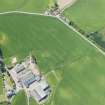
DP 217352 |
Oblique aerial view of Carriston farmsteading and the cropmarks of the cattle feed bin stances, looking WNW. |
12/6/2015 |
Item Level |
 |
On-line Digital Images |
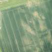
DP 217364 |
Oblique aerial view of the cropmarks of the settlement at Standingstone, looking E. |
12/6/2015 |
Item Level |
 |
On-line Digital Images |
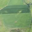
DP 217350 |
Oblique aerial view of the line of the anti-tank ditch, looking E. |
12/6/2015 |
Item Level |
 |
On-line Digital Images |
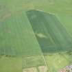
DP 217351 |
Oblique aerial view of the line of the anti-tank ditch, looking N. |
12/6/2015 |
Item Level |
 |
On-line Digital Images |
DP 217353 |
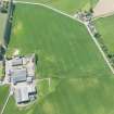
Oblique aerial view of Carriston farmsteading and the cropmarks of the cattle feed bin stances, looking W. |
12/6/2015 |
Item Level |
 |
On-line Digital Images |
DP 217354 |
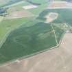
General obliaue aerial view across the site of the cropmarks, looking WNW. |
12/6/2015 |
Item Level |
 |
On-line Digital Images |
DP 217355 |
Oblique aerial view of the cropmarks of the enclosures, looking ENE. |
12/6/2015 |
Item Level |
 |
On-line Digital Images |
DP 217356 |
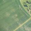
Oblique aerial view of the cropmarks of the ring ditch, looking NW. |
12/6/2015 |
Item Level |
 |
On-line Digital Images |
DP 217357 |
Oblique aerial view of the cropmarks of the ring ditch, looking SW. |
12/6/2015 |
Item Level |
 |
On-line Digital Images |
DP 217358 |
Oblique aerial view of the cropmarks of the ring ditch, looking SSE. |
12/6/2015 |
Item Level |
 |
On-line Digital Images |
DP 217359 |
Oblique aerial view of the cropmarks of the rectilinear settlement and the ring ditch, looking NNE. |
12/6/2015 |
Item Level |
 |
On-line Digital Images |
DP 217360 |
Oblique aerial view of the cropmarks of the rectilinear settlement and the ring ditch, looking WNW. |
12/6/2015 |
Item Level |
 |
On-line Digital Images |
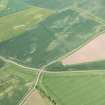
DP 217361 |
Oblique aerial view of the cropmarks of the settlement at Standingstone, looking NNE. |
12/6/2015 |
Item Level |
 |
On-line Digital Images |
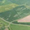
DP 217362 |
Oblique aerial view of the cropmarks of the settlement at Standingstone, looking NNE. |
12/6/2015 |
Item Level |
 |
On-line Digital Images |
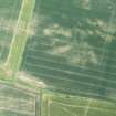
DP 217363 |
Oblique aerial view of the cropmarks of the settlement at Standingstone, looking SSE. |
12/6/2015 |
Item Level |
