Sortie 2015/11
551 178/2019/11
Description Sortie 2015/11
Date 4/5/2015
Collection RCAHMS Aerial Photography Digital
Catalogue Number 551 178/2019/11
Category All Other
Permalink http://canmore.org.uk/collection/1474473
Description Sortie 2015/11
Date 4/5/2015
Collection RCAHMS Aerial Photography Digital
Catalogue Number 551 178/2019/11
Category All Other
Permalink http://canmore.org.uk/collection/1474473
Collection Level (551 178) RCAHMS Aerial Photography Digital
> Group Level (551 178/2019) 2015 Photographs
>> Sub-Group Level (551 178/2019/11) Sortie 2015/11
| Preview | Category | Catalogue Number | Title | Date | Level |
|---|---|---|---|---|---|
| Digital Files (Non-image) | TM 000726 | GPS recorded flight path and map for Sortie 2015/11 | 4/5/2015 | Item Level | |
 |
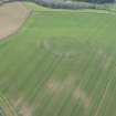
On-line Digital Images | DP 210878 | Oblique aerial view of cropmarks of the settlement at West Garleton House, looking S. | 4/5/2015 | Item Level |
 |
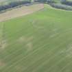
On-line Digital Images | DP 210879 | Oblique aerial view of cropmarks of the settlement at West Garleton House, looking E. | 4/5/2015 | Item Level |
 |
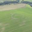
On-line Digital Images | DP 210880 | Oblique aerial view of cropmarks of the settlement at West Garleton House, looking N. | 4/5/2015 | Item Level |
 |
On-line Digital Images | DP 210881 | Oblique aerial view of the cropmarks of the military building and the cropmarks of a possible building at Alderston Hill, looking E. | 4/5/2015 | Item Level |
 |
On-line Digital Images | DP 210882 | Oblique aerial view of the cropmarks of the military building and the cropmarks of a possible building, looking E. | 4/5/2015 | Item Level |
 |
On-line Digital Images | DP 210883 | Oblique aerial view of the cropmarks of the military building and the cropmarks of a possible building, looking NE. | 4/5/2015 | Item Level |
 |
On-line Digital Images | DP 210884 | Oblique aerial view of the cropmarks of the military building and the cropmarks of a possible building, looking NE. | 4/5/2015 | Item Level |
 |
On-line Digital Images | DP 210885 | Oblique aerial view of the cropmarks of the fort, looking NW. | 4/5/2015 | Item Level |
 |
On-line Digital Images | DP 210886 | Oblique aerial view of the cropmarks of the fort, looking W. | 4/5/2015 | Item Level |
 |
On-line Digital Images | DP 210887 | Oblique aerial view of the cropmarks of the fort, looking W. | 4/5/2015 | Item Level |
 |
On-line Digital Images | DP 210890 | Oblique aerial view of the cropmarks of the settlement at the Pleasants, looking S. | 4/5/2015 | Item Level |
 |
On-line Digital Images | DP 210892 | Oblique aerial view of cropmarks of the enclosure and rig and furrow at Thirdpart Crossing, looking S. | 4/5/2015 | Item Level |
 |
On-line Digital Images | DP 210895 | General oblique aerial view of the North Fog Horn on the Isle of May, looking E. | 4/5/2015 | Item Level |
 |
On-line Digital Images | DP 210897 | Oblique aerial view of the New Lighthouse, Keepers Cottage on the Isle of May, looking E. | 4/5/2015 | Item Level |
 |
On-line Digital Images | DP 210900 | General oblique aerial view of the Isle of May, looking N. | 4/5/2015 | Item Level |
 |
On-line Digital Images | DP 210902 | Oblique aerial view of Low Lighthouse and cottages and the New Lighthouse on the Isle of May, looking N. | 4/5/2015 | Item Level |
 |
On-line Digital Images | DP 210904 | Oblique aerial view of the North Horn on the Isle of May, looking N. | 4/5/2015 | Item Level |
 |
On-line Digital Images | DP 210905 | Oblique aerial view of the Low Lighthouse and Cottages and the New Lighthouse on the Isle of May, looking N. | 4/5/2015 | Item Level |
 |
On-line Digital Images | DP 210908 | General oblique aerial view of the Isle of May, looking S. | 4/5/2015 | Item Level |
 |
On-line Digital Images | DP 210910 | Oblique aerial view of the New and Low Lighthouses, the Lighthouse and Keepers Cottage, and The Beacon on the Isle of May, looking NE. | 4/5/2015 | Item Level |
 |
On-line Digital Images | DP 210913 | Oblique aerial view of the cropmarks of the linear features, possible quarry and rectilinear enclosure at Troustrie, looking NE. | 4/5/2015 | Item Level |
 |
On-line Digital Images | DP 210916 | Oblique aerial view of the grassmarks of the ring ditch at Gilliesfaulds, looking E. | 4/5/2015 | Item Level |
 |
On-line Digital Images | DP 210918 | Oblique aerial view of the grassmarks of the ring ditch at Gilliesfaulds, looking W. | 4/5/2015 | Item Level |

© Historic Environment Scotland. Scottish Charity No. SC045925