Sortie 2014/40
551 178/2018/35
Description Sortie 2014/40
Collection RCAHMS Aerial Photography Digital
Catalogue Number 551 178/2018/35
Category All Other
Permalink http://canmore.org.uk/collection/1434511
Description Sortie 2014/40
Collection RCAHMS Aerial Photography Digital
Catalogue Number 551 178/2018/35
Category All Other
Permalink http://canmore.org.uk/collection/1434511
Collection Level (551 178) RCAHMS Aerial Photography Digital
> Sub-Group Level (551 178/2018) 2014 Photographs
>> Sub-Group Level (551 178/2018/35) Sortie 2014/40
| Preview | Category | Catalogue Number | Title | Date | Level |
|---|---|---|---|---|---|
| Digital Files (Non-image) | TM 000796 | GPS recorded flight path and map for Sortie 2014/40 | 22/7/2014 | Item Level | |
 |
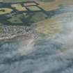
On-line Digital Images | DP 193917 | Oblique aerial view of the cropmarks, looking NE. | 22/7/2014 | Item Level |
 |
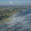
On-line Digital Images | DP 193918 | General oblique aerial view of Elie with the haar on the Forth, looking NE. | 22/7/2014 | Item Level |
 |
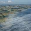
On-line Digital Images | DP 193919 | General oblique aerial view the East Neuk of Fife from Elie towards Crail with the haar on the Forth, looking NE. | 22/7/2014 | Item Level |
 |
On-line Digital Images | DP 193920 | General oblique aerial view the East Neuk of Fife from Elie towards Crail with the haar on the Forth, looking NE. | 22/7/2014 | Item Level |
 |
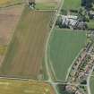
On-line Digital Images | DP 193921 | Oblique aerial view of the cropmarks of the field boundaries with Castle Mains Farm and Dirleton castle beyond, looking WSW. | 22/7/2014 | Item Level |
 |
On-line Digital Images | DP 193922 | Oblique aerial view of the cropmarks of the field boundaries with Castle Mains Farm and Dirleton castle beyond, looking SW. | 22/7/2014 | Item Level |
 |
On-line Digital Images | DP 193925 | General oblique aerial view with Huntington House in the middle distance and Haddington and the Garleton Hills beyond, looking ESE. | 22/7/2014 | Item Level |
 |
On-line Digital Images | DP 193927 | Oblique aerial view of the cropmarks of the settlement enclosure and round houses, looking NNW. | 22/7/2014 | Item Level |
 |
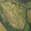
On-line Digital Images | DP 193929 | Oblique aerial view of the cropmarks of the rectilinear settlement enclosure, looking W. | 22/7/2014 | Item Level |
 |
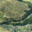
On-line Digital Images | DP 193931 | Oblique aerial view of the cropmarks of the forts, looking E. | 22/7/2014 | Item Level |
 |
On-line Digital Images | DP 193934 | Oblique aerial view of the cropmarks of the fort and settlement, looking NNW. | 22/7/2014 | Item Level |
 |
On-line Digital Images | DP 193936 | Oblique aerial view of the cropmarks of the fort, looking NNW. | 22/7/2014 | Item Level |
 |
On-line Digital Images | DP 193938 | Oblique aerial view of the cropmarks of the fort, looking S. | 22/7/2014 | Item Level |
 |
On-line Digital Images | DP 193939 | Oblique aerial view of the cropmarks of the fort, looking SSE. | 22/7/2014 | Item Level |
 |
On-line Digital Images | DP 193940 | Oblique aerial view of the cropmarks of the fort, looking E. | 22/7/2014 | Item Level |
 |
On-line Digital Images | DP 193941 | Oblique aerial view of the cropmarks of the settlement, looking NNW. | 22/7/2014 | Item Level |
 |
On-line Digital Images | DP 193942 | Oblique aerial view of the cropmarks of the settlement, looking WSW. | 22/7/2014 | Item Level |
 |
On-line Digital Images | DP 193943 | Oblique aerial view of the cropmarks of the settlement, looking S. | 22/7/2014 | Item Level |
 |
On-line Digital Images | DP 193944 | Oblique aerial view of the cropmarks of the enclosure, looking ENE. | 22/7/2014 | Item Level |
 |
On-line Digital Images | DP 193945 | Oblique aerial view of the cropmarks of the enclosure, looking NNW. | 22/7/2014 | Item Level |
 |
On-line Digital Images | DP 193947 | Oblique aerial view of the cropmarks of the settlement enclosure, looking NE. | 22/7/2014 | Item Level |
 |
On-line Digital Images | DP 193949 | Oblique aerial view of Midlem village and the surrounding field pattern, looking N. | 22/7/2014 | Item Level |
 |
On-line Digital Images | DP 193952 | Oblique aerial view of the cropmarks of the fort, looking WSW. | 22/7/2014 | Item Level |

© Historic Environment Scotland. Scottish Charity No. SC045925