|
All Other |
DC 40994 |
Plan of archaeological landscape at Little Rogart - See GV005395 for a working copy. |
|
Item Level |
|
All Other |
DC 40995 |
Plan of archaeological landscape at Rhaoine |
|
Item Level |
|
All Other |
DC 40978 |
Plan of three square cairns at Lettie's Grave |
18/5/1995 |
Item Level |
|
All Other |
DC 40985 |
Plan of U-shaped burnt mound at Achork |
18/5/1995 |
Item Level |
|
All Other |
MS 731/17 |
Afforestable Land Survey field database (Rogart survey, 1995). Held as attribute table in GIS and in Oracle Field/AP table. Please see DX001425 |
1995 |
Item Level |
|
Digital Files (Non-image) |
GV 005395 |
Updated version of Illustrator drawing of the archaeological landscape of Little Rogart |
23/4/2014 |
Item Level |
|
Digital Files (Non-image) |
DX 001425 |
RCAHMS Structures Database - Rogart |
1995 |
Item Level |
|
Digital Files (Non-image) |
GV 008151 |
Plan of archaeological landscape at Rhaoine |
1995 |
Item Level |
|
Digital Files (Non-image) |
TM 000355 |
Zip file containing all survey linework collected during the RCAHMS Afforestable Land Survey of the Rogart area 1995. |
1995 |
Item Level |
|
Digital Files (Non-image) |
TM 002205 |
Zip file containing all survey linework collected during the RCAHMS Afforestable Land Survey of the Rogart area 1995. SHP and Geojson file formats with extra attribution added to the linework. |
1995 |
Item Level |
 |
On-line Digital Images |
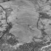
SC 503654 |
Little Rogart, oblique aerial view, taken from the SE, showing an area defined as an archaeological landscape. |
|
Item Level |
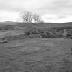 |
On-line Digital Images |
SC 576042 |
Grumby farmstead: view from NW corner of stackyard to N of main range, with detail of stack stands |
1996 |
Item Level |
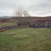 |
On-line Digital Images |
SC 576044 |
Grumby farmstead: view from NW corner of stackyard to N of main range, with detail of stack stands |
1996 |
Item Level |
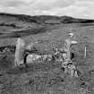 |
On-line Digital Images |
SC 589884 |
Scanned image of Lettie's Grave from SE. |
1996 |
Item Level |
 |
On-line Digital Images |
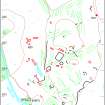
SC 1417715 |
Tif version of Illustrator drawing of the archaeological landscape of Little Rogart |
23/4/2014 |
Item Level |
 |
On-line Digital Images |
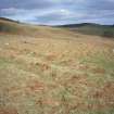
SC 1499233 |
Leataidh: view of byre-dwelling (Rog95 709) from NW |
1995 |
Item Level |
 |
On-line Digital Images |
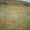
SC 1499234 |
Leataidh: view of byre-dwelling (Rog95 709) from W |
1995 |
Item Level |
 |
On-line Digital Images |
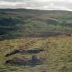
SC 1499235 |
Leataidh: view of byre-dwelling (Rog95 709) from E |
1995 |
Item Level |
 |
On-line Digital Images |
SC 1499236 |
Leataidh: view of byre-dwelling (Rog95 709) from E |
1995 |
Item Level |
 |
On-line Digital Images |
SC 1499237 |
Leataidh an Raidhrich township; view of corn-drying kiln (Rog95 557) from SW |
1995 |
Item Level |
 |
On-line Digital Images |
SC 1499238 |
Lettie's Grave: RCAHMS at work. Mr Robert Shaw at plane-table |
1995 |
Item Level |
 |
On-line Digital Images |
SC 1499239 |
Leataidh an Raidhrich township; view of corn-drying kiln (Rog95 557) from S |
1995 |
Item Level |
 |
On-line Digital Images |
SC 1499240 |
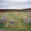
Leataidh an Raidhrich township; view of building (Rog95 559) from W |
1995 |
Item Level |
 |
On-line Digital Images |
SC 1499241 |
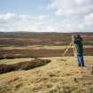
Leataidh an Raidhrich township; view of building (Rog95 559) |
1995 |
Item Level |


