|
Digital Files (Non-image) |
TM 000831 |
GPS recorded flight path and map for Sortie 2013/28 |
18/7/2013 |
Item Level |
 |
On-line Digital Images |
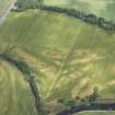
DP 166998 |
Oblique aerial view of the cropmarks at Balmakewan, looking NE. |
18/7/2013 |
Item Level |
 |
On-line Digital Images |
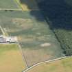
DP 167087 |
Oblique aerial view of the cropmarks at Ardunie, looking S. |
18/7/2013 |
Item Level |
 |
On-line Digital Images |
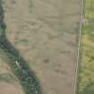
DP 167019 |
Oblique aerial view centred on the cropmarks at Inchbare and Smiddyhill, looking ESE. |
18/7/2013 |
Item Level |
 |
On-line Digital Images |
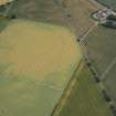
DP 166905 |
Oblique aerial view of cropmarks of the cursus, enclosures, ring ditches and barrows at Old Montrose, looking SW. |
18/7/2013 |
Item Level |
 |
On-line Digital Images |
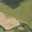
DP 166983 |
Oblique aerial view of the cropmarks at Drumnagair, looking SE. |
18/7/2013 |
Item Level |
 |
On-line Digital Images |
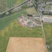
DP 166971 |
Oblique aerial view of cropmarks at Leithfield, looking SE. |
18/7/2013 |
Item Level |
 |
On-line Digital Images |
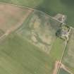
DP 166972 |
Oblique aerial view of the cropmarks at Waterlair Farm, looking NNE. |
18/7/2013 |
Item Level |
 |
On-line Digital Images |
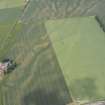
DP 166974 |
Oblique aerial view of the cropmarks (natural in the main) at Powburn, looking SSE. |
18/7/2013 |
Item Level |
 |
On-line Digital Images |
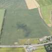
DP 166975 |
Oblique aerial view of the cropmarks at Scotston, looking SE. |
18/7/2013 |
Item Level |
 |
On-line Digital Images |
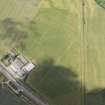
DP 166978 |
Oblique aerial view of the cropmarks of the pit alignment at Drumnagair, looking NW. |
18/7/2013 |
Item Level |
 |
On-line Digital Images |
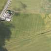
DP 166979 |
Oblique aerial view of the cropmarks of the pit alignment at Drumnagair, looking SW. |
18/7/2013 |
Item Level |
 |
On-line Digital Images |
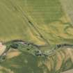
DP 166982 |
Oblique aerial view. |
18/7/2013 |
Item Level |
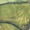 |
On-line Digital Images |
DP 166996 |
Oblique aerial view of the cropmarks at Balmakewan, looking ENE. |
18/7/2013 |
Item Level |
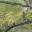 |
On-line Digital Images |
DP 166997 |
Oblique aerial view of the cropmarks at Balmakewan, looking ENE. |
18/7/2013 |
Item Level |
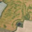 |
On-line Digital Images |
DP 166885 |
Oblique aerial view of the cropmarks of the unenclosed and palisaded settlements, enclosures, linear features and pits, looking SW. |
18/7/2013 |
Item Level |
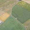 |
On-line Digital Images |
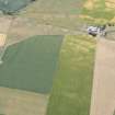
DP 166887 |
Oblique aerial view of the cropmarks of the possible ring-ditches, round houses and rig, looking S. |
18/7/2013 |
Item Level |
 |
On-line Digital Images |
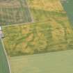
DP 166889 |
Oblique aerial view of the cropmarks of the possible ring-ditches, round houses and rig, looking SSE. |
18/7/2013 |
Item Level |
 |
On-line Digital Images |
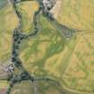
DP 166892 |
Oblique aerial view of the cropmarks of the enclosure and pit alignment, looking SSE. |
18/7/2013 |
Item Level |
 |
On-line Digital Images |
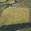
DP 166893 |
Oblique aerial view centred on the cropmarks of the unenclosed settlement, barrows, linear features and pits, looking SE. |
18/7/2013 |
Item Level |
 |
On-line Digital Images |
DP 166895 |
Oblique aerial view centred on the cropmarks of the unenclosed settlement, barrows, timber halls, linear features and pits, looking NE. |
18/7/2013 |
Item Level |
 |
On-line Digital Images |
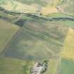
DP 167044 |
Oblique aerial view centred on the cropmark cultivation remains at Balnabriech looking S. |
18/7/2013 |
Item Level |
 |
On-line Digital Images |
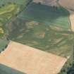
DP 167047 |
Oblique aerial view centred on the ring ditch at Bulgarrock, looking SW. |
18/7/2013 |
Item Level |
 |
On-line Digital Images |
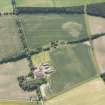
DP 167049 |
Oblique aerial view centred on the farmstead at Nether Balgillo, with cropmarks in the adjacent fields, looking S. |
18/7/2013 |
Item Level |


