Sortie 2013/37
551 178/2017/21
Description Sortie 2013/37
Collection RCAHMS Aerial Photography Digital
Catalogue Number 551 178/2017/21
Category All Other
Permalink http://canmore.org.uk/collection/1348924
We use cookies to improve your experience on our site and show you personalised advertising.
Find out more from our privacy notice and cookie policy.
Your optionsDescription Sortie 2013/37
Collection RCAHMS Aerial Photography Digital
Catalogue Number 551 178/2017/21
Category All Other
Permalink http://canmore.org.uk/collection/1348924
Collection Level (551 178) RCAHMS Aerial Photography Digital
> Sub-Group Level (551 178/2017) 2013 Photographs
>> Sub-Group Level (551 178/2017/21) Sortie 2013/37
| Preview | Category | Catalogue Number | Title | Date | Level |
|---|---|---|---|---|---|
| Digital Files (Non-image) | TM 000845 | GPS recorded flight path and map for Sortie 2013/37 | 12/8/2013 | Item Level | |
 |
On-line Digital Images | DP 160769 | General oblique aerial view of the Dornoch Firth Bridge, looking NW. | 13/8/2013 | Item Level |
 |
On-line Digital Images | DP 160770 | General oblique aerial view of Dunnet Bay with Dunnet Head and Hoy beyond, looking NW. | 13/8/2013 | Item Level |
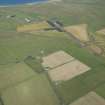 |
On-line Digital Images | DP 160771 | Oblique aerial view of Castletown airfield, looking NNW. | 13/8/2013 | Item Level |
 |
On-line Digital Images | DP 160772 | RCAHMS aerial survey aircraft being refuelled on the apron at Wick. | 13/8/2013 | Item Level |
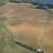 |
On-line Digital Images | DP 160750 | Oblique aerial view of the cropmarks of the rig with Waterside farmstead beyond, looking WSW. | 13/8/2013 | Item Level |
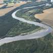 |
On-line Digital Images | DP 160751 | General oblique aerial view of the River Spey at 'Cumberland's Ford', looking SSE. | 13/8/2013 | Item Level |
 |
On-line Digital Images | DP 160753 | Oblique aerial view of the cropmarks of the possible round houses and pits, looking SSE. | 13/8/2013 | Item Level |
 |
On-line Digital Images | DP 160754 | Oblique aerial view of the Benriach and Longmorn distilleries, looking SSE. | 13/8/2013 | Item Level |
 |
On-line Digital Images | DP 160755 | Oblique aerial view of the cropmarks of the enclosure, looking WSW. | 13/8/2013 | Item Level |
 |
On-line Digital Images | DP 160756 | Oblique aerial view of the cropmarks of the souterrains, looking S. | 13/8/2013 | Item Level |
 |
On-line Digital Images | DP 160757 | Oblique aerial view of the cropmarks of the old water courses and the enclosure, looking SSE. | 13/8/2013 | Item Level |
 |
On-line Digital Images | DP 160758 | Oblique aerial view of the cropmarks of the old water courses and the enclosure, looking NE. | 13/8/2013 | Item Level |
 |
On-line Digital Images | DP 160759 | Oblique aerial view of the cropmarks of the enclosure and the small oval structures, looking SSE. | 13/8/2013 | Item Level |
 |
On-line Digital Images | DP 160760 | Oblique aerial view of Castletown, looking NNE. | 13/8/2013 | Item Level |
 |
On-line Digital Images | DP 160763 | General oblique aerial view of Errol village and Errol Park House, looking NNW. | 13/8/2013 | Item Level |
 |
On-line Digital Images | DP 160765 | Oblique aerial view of Dunnottar Castle, looking WNW. | 13/8/2013 | Item Level |
 |
On-line Digital Images | DP 160768 | Oblique aerial view of the cropmarks of the enclosures and the remainsof the fish trap, looking WSW. | 13/8/2013 | Item Level |
 |
On-line Digital Images | DP 160762 | General oblique aerial view of the meander in the River Earn, looking WNW. | 13/8/2013 | Item Level |
 |
On-line Digital Images | DP 160764 | Oblique aerial view of Dunnottar Castle, looking N. | 13/8/2013 | Item Level |
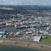 |
On-line Digital Images | DP 160766 | Oblique aerial view of Aberdeen harbour, looking WSW. | 13/8/2013 | Item Level |
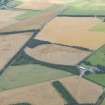 |
On-line Digital Images | DP 160767 | General oblique aerial view of the cropmarks at Balblair, looking WSW. | 13/8/2013 | Item Level |

© Historic Environment Scotland. Scottish Charity No. SC045925