Sortie 2013/36
551 178/2017/20
Description Sortie 2013/36
Collection RCAHMS Aerial Photography Digital
Catalogue Number 551 178/2017/20
Category All Other
Permalink http://canmore.org.uk/collection/1348923
Description Sortie 2013/36
Collection RCAHMS Aerial Photography Digital
Catalogue Number 551 178/2017/20
Category All Other
Permalink http://canmore.org.uk/collection/1348923
Collection Level (551 178) RCAHMS Aerial Photography Digital
> Sub-Group Level (551 178/2017) 2013 Photographs
>> Sub-Group Level (551 178/2017/20) Sortie 2013/36
| Preview | Category | Catalogue Number | Title | Date | Level |
|---|---|---|---|---|---|
 |
On-line Digital Images | DP 160707 | Oblique aerial view of the cropmarks of the Roman Temporary Camp at Lochrutton, looking W. | 6/8/2013 | Item Level |
 |
On-line Digital Images | DP 160710 | Oblique aerial view of the cropmarks of the Roman Temporary Camp at Lochrutton, looking N. | 6/8/2013 | Item Level |
 |
On-line Digital Images | DP 160720 | Oblique aerial view of the cropmarks of the settlements and field boundaries at Cragie Burn, looking W. | 6/8/2013 | Item Level |
 |
On-line Digital Images | DP 160722 | Oblique aerial view of the cropmarks of the possible enclosure at Heatheryhall, looking E. | 6/8/2013 | Item Level |
 |
On-line Digital Images | DP 160724 | Oblique aerial view Carstairs, looking W. | 6/8/2013 | Item Level |
 |
On-line Digital Images | DP 160731 | General oblique aerial view of coastal defences at Blackneuk Craigs, looking SW. | 6/8/2013 | Item Level |
 |
On-line Digital Images | DP 160733 | Oblique aerial view of the Mote of Urr, looking E. | 6/8/2013 | Item Level |
 |
On-line Digital Images | DP 160735 | Oblique aerial view of the Mote of Urr, looking NW. | 6/8/2013 | Item Level |
 |
On-line Digital Images | DP 160737 | Oblique aerial view of the Mote of Urr, looking SW. | 6/8/2013 | Item Level |
 |
On-line Digital Images | DP 160739 | General oblique aerial view of the River Dee with Kirkcudbright in the distance, looking S. | 6/8/2013 | Item Level |
 |
On-line Digital Images | DP 160740 | General oblique aerial view with Threave Castle in the foreground and Castle Douglas beyond, looking E. | 6/8/2013 | Item Level |
 |
On-line Digital Images | DP 160744 | Oblique aerial view of the dockyard at Rosyth, looking NNE. | 6/8/2013 | Item Level |
 |
On-line Digital Images | DP 160746 | Oblique aerial view of the demolition of the oil storage tanks at Rosyth, looking W. | 6/8/2013 | Item Level |
 |
On-line Digital Images | DP 160748 | Oblique aerial view of the works at Cowdenbeath, looking NNW. | 6/8/2013 | Item Level |
 |
On-line Digital Images | DP 160702 | Oblique aerial view of Threave Castle, looking S. | 6/8/2013 | Item Level |
 |
On-line Digital Images | DP 160686 | Oblique aerial view of the cropmarks of the field boundaries and drains at Dalsruscan, looking E. | 6/8/2013 | Item Level |
 |
On-line Digital Images | DP 160688 | Oblique aerial view of the cropmarks of the field boundaries and drains at Dalruscan, looking NE. | 6/8/2013 | Item Level |
 |
On-line Digital Images | DP 160690 | Oblique aerial view of the cropmarks of the enclosures and field boundaries at Dalruscan, looking N. | 6/8/2013 | Item Level |
 |
On-line Digital Images | DP 160692 | Oblique aerial view of the cropmarks of the enclosures and field boundaries at Dalruscan, looking W. | 6/8/2013 | Item Level |
 |
On-line Digital Images | DP 160693 | Oblique aerial view of the cropmarks of the field boundary and linear feature at Dalsruscan, looking W. | 6/8/2013 | Item Level |
 |
On-line Digital Images | DP 160725 | Oblique aerial view of the roadworks on the A75 with Carrutherstown in the distance, looking NW. | 6/8/2013 | Item Level |
 |
On-line Digital Images | DP 160726 | General oblique aerial view of the roadworks on the A75 with Carrutherstown in the distance, looking NW. | 6/8/2013 | Item Level |
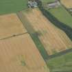 |
On-line Digital Images | DP 160684 | Oblique aerial view of the cropmarks of the fort at Gars Hill, looking NW. | 6/8/2013 | Item Level |
 |
On-line Digital Images | DP 160703 | Oblique aerial view of the site of the possible settlement at Mossyard, looking NW. | 6/8/2013 | Item Level |

© Historic Environment Scotland. Scottish Charity No. SC045925