551 177/29
Description 2004 Photographs
Collection RCAHMS Aerial Photography
Catalogue Number 551 177/29
Category All Other
Permalink http://canmore.org.uk/collection/1346499
Collection Hierarchy - Sub-Group Level
Collection Level (551 177) RCAHMS Aerial Photography
> Sub-Group Level (551 177/29) 2004 Photographs
| Preview | Category | Catalogue Number | Title | Date | Level |
|---|---|---|---|---|---|
 |
On-line Digital Images | SC 926206 | Oblique aerial view of three ruined farmsteads at Cuiltrannich, Lochtayside. . Taken from SW. | 18/2/2004 | Item Level |
 |
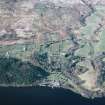
On-line Digital Images | SC 926207 | Oblique aerial view of the landscape and field systems at Morenish, Lochtayside, from Tomocrocher in the west to Edramucky in the east. Centred on the former farms of Blarliargan and Milton Morenish (now a holiday park) and Rynachulig. Taken from SE. | 18/2/2004 | Item Level |
 |
On-line Digital Images | SC 926209 | Oblique aerial view of head-dykes and braided trackways above Ben Lawers and Easter Croftintygan farms, Lochtayside. Taken from SE. | 18/2/2004 | Item Level |
 |
On-line Digital Images | SC 926210 | Oblique aerial view of the landscape, field systems and farmsteads to the east of Lawers Burn, from Machuim in the west to Shenlarich in the east. Taken from SE. | 18/2/2004 | Item Level |
| Photographs and Off-line Digital Images | E 50588 CN | Oblique aerial view centred on the Queen Mary II cruise liner with road bridge and rail bridge adjacent, taken from the E. | 13/7/2004 | Item Level | |
 |
On-line Digital Images | SC 926211 | Oblique aerial view of the landscape, field systems and farmsteads on the farms of Tombreck, Craggantoul and Cragganester, all in the former district of Crannich, Lochtayside. Taken from SE. | 18/2/2004 | Item Level |
 |
On-line Digital Images | SC 926212 | Oblique aerial view of the landscape, field systems and farmsteads on the farms of Cragganester, Balnahanaid and Balnasuim, all in the former district of Crannich, Lochtayside. Taken from SE. | 18/2/2004 | Item Level |
 |
On-line Digital Images | SC 926213 | Oblique aerial view of the landscape, field systems and farmsteads on the farms of Balnahanaid and Balnasuim, in the former district of Crannich, Lochtayside. Taken from SE. | 18/2/2004 | Item Level |
 |
On-line Digital Images | SC 926214 | Oblique aerial view of the landscape, field systems and farmsteads on the farms of Carie and Tombreck, Lochtayside. Taken from SE. | 18/2/2004 | Item Level |
 |
On-line Digital Images | SC 926216 | Oblique aerial view of the landscape and field systems on the farms of Kiltyrie and Carie, Lochtayside. Taken from SE. | 18/2/2004 | Item Level |
 |
On-line Digital Images | SC 926217 | Oblique aerial view of the landscape, field systems and farmsteads on Easter Croftintygan and Ben Lawers Farm, Lochtayside. Taken from SE. | 18/2/2004 | Item Level |
 |
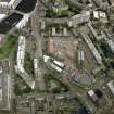
On-line Digital Images | SC 925982 | Oblique aerial view centred on the excavation of the Black Vaults, Edinburgh, with the warehouses and offices adjacent, taken from the SW. | 13/7/2004 | Item Level |
 |
On-line Digital Images | SC 926219 | Oblique aerial view of the landscape, field systems and farmsteads to the east of Lawers Burn, from Machuim in the west to Shenlarich in the east. Taken from SE. | 18/2/2004 | Item Level |
 |
On-line Digital Images | SC 961451 | General oblique aerial view looking across Thurso towards Scrabster and Holborn Head, taken from the SSW. | 28/4/2004 | Item Level |
| Photographs and Off-line Digital Images | E 40898 CN | General oblique aerial view looking across the village towards the crofting township and radar station, taken from the W. | 28/4/2004 | Item Level | |
| Photographs and Off-line Digital Images | E 40899 CN | General oblique aerial view looking across the village towards the crofting township and radar station, taken from the WSW. | 28/4/2004 | Item Level | |
| Photographs and Off-line Digital Images | E 40881 CN | General oblique aerial view looking across the remains of the radar station towards the Kyle of Durness, taken from the NE. | 28/4/2004 | Item Level | |
| Photographs and Off-line Digital Images | E 40882 CN | General oblique aerial view looking across the remains of the radar station towards the Kyle of Durness, taken from the NE. | 28/4/2004 | Item Level | |
| Photographs and Off-line Digital Images | E 43577 | Oblique aerial view centred on the remains of the radar station, taken from the WNW. | 28/4/2004 | Item Level | |
| Photographs and Off-line Digital Images | E 43578 | Oblique aerial view centred on the remains of the radar station, taken from the W. | 28/4/2004 | Item Level | |
| Photographs and Off-line Digital Images | E 43579 | Oblique aerial view centred on the remains of the radar station, taken from the SW. | 28/4/2004 | Item Level | |
| Photographs and Off-line Digital Images | E 40883 CN | Oblique aerial view centred on the remains of the radar station, taken from the WSW. | 28/4/2004 | Item Level | |
| Photographs and Off-line Digital Images | E 40884 CN | Oblique aerial view centred on the remains of the radar station, taken from the SW. | 28/4/2004 | Item Level | |
| Photographs and Off-line Digital Images | E 40885 CN | Oblique aerial view centred on the remains of the radar station, taken from the SSE. | 28/4/2004 | Item Level |


