 |
On-line Digital Images |
SC 993206 |
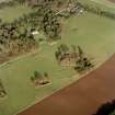
Scanned image of oblique aerial view centred on the deserted medieval village, bastle, church and burial ground, with remains of the rig, possible enclosures, country house and walled garden adjacent, taken from the SW. |
25/1/2001 |
Item Level |
 |
On-line Digital Images |
SC 993207 |
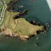
Scanned image of oblique aerial view centred on the remains of the artillery fortification, taken from the SE. |
25/1/2001 |
Item Level |
 |
On-line Digital Images |
SC 993208 |
Scanned image of oblique aerial view centred on the remains of the field system and rig with the remains of the sheepfold and enclosure adjacent, taken from the SW. |
15/1/2001 |
Item Level |
 |
On-line Digital Images |
SC 993209 |
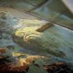
Scanned image of oblique aerial view centred on the remains of the fort with the remains of the fort, castle and enclosure adjacent, taken from the WSW. |
15/1/2001 |
Item Level |
 |
On-line Digital Images |
SC 993210 |
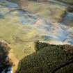
Scanned image of oblique aerial view centred on the remains of the fort and castle with the remains of the cultivation terraces and enclosure adjacent, taken from the E. |
15/1/2001 |
Item Level |
 |
On-line Digital Images |
SC 993211 |
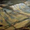
Scanned image of oblique aerial view centred on the remains of scooped settlements, cultivation terraces and small cairns, taken from the E. |
15/1/2001 |
Item Level |
 |
On-line Digital Images |
SC 993212 |
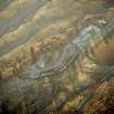
Scanned image of general oblique aerial view centred on the farmhouse and farmsteading with the remains of the scooped settlement adjacent, taken from the NNW |
15/1/2001 |
Item Level |
 |
On-line Digital Images |
SC 993213 |
Scanned image of oblique aerial view centred on the scooped settlement, taken from the NE. |
15/1/2001 |
Item Level |
 |
On-line Digital Images |
SC 993214 |
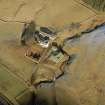
Scanned image of oblique aerial view centred on the farmhouse and farmsteading with the remains of the bastle house adjacent, taken from the SSW |
15/1/2001 |
Item Level |
 |
On-line Digital Images |
SC 993215 |
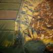
Scanned image of oblique aerial view centred on the remains of the scooped settlement and enclosure with the remains of the sheepfold, cairn and cist adjacent, taken from the SSW. |
15/1/2001 |
Item Level |
 |
On-line Digital Images |
SC 993221 |
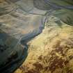
Scanned image of oblique aerial view centred on the remains of the farmstead, buildings, rig and cultivation terraces with the remains of the possible settlement and enclosure adjacent, taken from the ENE. |
15/1/2001 |
Item Level |
 |
On-line Digital Images |
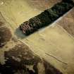
SC 993222 |
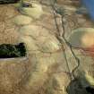
Scanned image of oblique aerial view centred on the remains of the farmstead with the remains of the farmstead adjacent, taken from the N. |
29/1/2001 |
Item Level |
 |
On-line Digital Images |
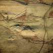
SC 993223 |
Scanned image of oblique aerial view centred on the remains of the farmstead with the remains of the farmstead adjacent, taken from the N. |
29/1/2001 |
Item Level |
 |
On-line Digital Images |
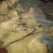
SC 993224 |
Scanned image of oblique aerial view centred on the remains of the farmstead with the remains of the farmstead adjacent, taken from the SW. |
29/1/2001 |
Item Level |
 |
On-line Digital Images |
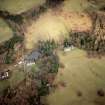
SC 993225 |
Scanned image of oblique aerial view centred on the remains of the farmstead, buildings and tower-house, with the remains of the farmstead adjacent, taken from the SSE. |
29/1/2001 |
Item Level |
 |
On-line Digital Images |
SC 993226 |
Scanned image of oblique aerial view centred on the country house with farmsteading adjacent, taken from the WNW. |
29/1/2001 |
Item Level |
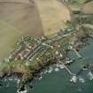 |
On-line Digital Images |
SC 993231 |
Scanned image of oblique aerial view centred on the village and harbour, taken from the ESE. |
25/1/2001 |
Item Level |
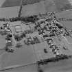 |
On-line Digital Images |
SC 1043649 |
Oblique aerial view centred on the hospital, taken from the NE. |
1/5/2001 |
Item Level |
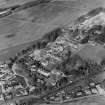 |
On-line Digital Images |
SC 1043901 |
Oblique aerial view of Murthly hospital, taken from the SW. |
1/5/2001 |
Item Level |
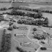 |
On-line Digital Images |
SC 1044223 |
Oblique aerial view of Ladysbridge hospital, Banff, taken from the NNW. |
18/7/2001 |
Item Level |
 |
On-line Digital Images |
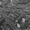
SC 1042710 |
Oblique aerial view centred on the hospital and churches, taken from the SW. |
26/4/2001 |
Item Level |
 |
On-line Digital Images |
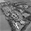
SC 1043675 |
Oblique aerial view centred on the hospital and offices, taken from the WNW. |
1/5/2001 |
Item Level |
 |
On-line Digital Images |
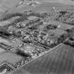
SC 1043692 |
General oblique aerial view of the hospitals with the distillery adjacent, taken from the WNW. |
1/5/2001 |
Item Level |
 |
On-line Digital Images |
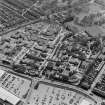
SC 1043703 |
Oblique aerial view centred on the hospital and obelisk, taken from the NE. |
1/5/2001 |
Item Level |


