 |
On-line Digital Images |
SC 505099 |
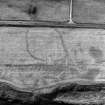
Hillend, settlement, enclosure and pits.
Oblique aerial view, taken from the SE, centred on the cropmarks of a settlement and enclosure. |
25/7/1995 |
Item Level |
 |
On-line Digital Images |
SC 505244 |
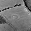
Bedrule, oblique aerial view, taken from the SW, centred on the cropmarks of a double-ditched settlement. |
1995 |
Item Level |
 |
On-line Digital Images |
SC 1519268 |
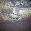
Hillhead, oblique aerial view, taken from the SW, showing the spoil heap of the coal mine, and a railway, in the centre of the photograph. |
1995 |
Item Level |
 |
On-line Digital Images |
SC 1519269 |
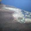
Hillhead, oblique aerial view, taken from the SW, showing the spoil heap of the coal mine, and a railway, in the centre right of the photograph. |
1995 |
Item Level |
 |
On-line Digital Images |
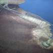
SC 1519270 |
Hillhead and Lochend Colliery, oblique aerial view, taken from the SW, showing the spoil heap of Hillhead coal mine in the bottom right-hand corner of the photograph, and Lochend Colliery in the top left-hand corner, with both joined by a railway. |
1995 |
Item Level |
 |
On-line Digital Images |
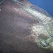
SC 1519271 |
Hillhead and Lochend Colliery, oblique aerial view, taken from the SW, showing the spoil heap of Hillhead coal mine in the bottom right-hand corner of the photograph, and Lochend Colliery in the top left-hand corner, both joined by a railway. |
1995 |
Item Level |
 |
On-line Digital Images |
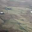
SC 1519272 |
Blackhill and Mountcow, oblique aerial view, taken from the N, showing Blackhill enclosures in the bottom left-hand corner of the photograph, and Mountcow ironstone mine in the centre, to the right of Mountcow farmstead. |
1995 |
Item Level |
 |
On-line Digital Images |
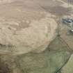
SC 1519273 |
Blackhill, oblique aerial view, taken from the NW, showing Blackhill enclosures in the centre left of the photograph. |
1995 |
Item Level |
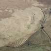 |
On-line Digital Images |
SC 1519274 |
Blackhill, oblique aerial view, taken from the NW, showing Blackhill enclosures in the centre of the photograph. |
1995 |
Item Level |
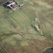 |
On-line Digital Images |
SC 1519275 |
Mountcow, oblique aerial view, taken from the NW, showing Mountcow ironstone mine in ther centre of the photograph. |
1995 |
Item Level |
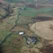 |
On-line Digital Images |
SC 1519276 |
Blackhill, oblique aerial view, taken from the SE, showing Blackhill enclosures in the centre right of the photograph. |
1995 |
Item Level |
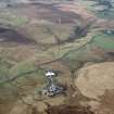 |
On-line Digital Images |
SC 1519277 |
Blackhill and Mountcow, oblique aerial view, taken from the E, showing Blackhill enclosures in the bottom right-hand corner of the photograph, and Mountcow ironstone mine at the left-hand edge. |
1995 |
Item Level |
 |
On-line Digital Images |
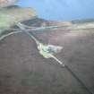
SC 1519265 |
Lochend Colliery, oblique aerial view, taken from the SW, showing the coal mine and railway in the centre of the photograph. |
1995 |
Item Level |
 |
On-line Digital Images |
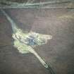
SC 1519266 |
Lochend Colliery, oblique aerial view, taken from the SW, showing the coal mine and railway in the centre of the photograph. |
1995 |
Item Level |
 |
On-line Digital Images |
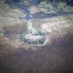
SC 1519267 |
Hillhead, oblique aerial view, taken from the SW, showing the spoil heap of the coal mine, and a railway, in the centre of the photograph. |
1995 |
Item Level |
 |
On-line Digital Images |
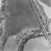
SC 1754579 |
Innermessan, oblique aerial view, taken from the SE, showing the cropmarks of a possible enclosure. |
29/6/1995 |
Item Level |
 |
On-line Digital Images |
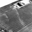
SC 1736716 |
Vogrie Grange, oblique aerial view, taken from the SSE, centred on the cropmark of a possible settlement. The West Lodge, Vogrie House is visible in the bottom centre half of the photograph. |
9/8/1995 |
Item Level |
 |
On-line Digital Images |
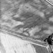
SC 1720228 |
Newton of Guthrie, oblique aerial view, taken from the SE, centred on the cropmarks of possible quarries. |
4/7/1995 |
Item Level |
 |
On-line Digital Images |
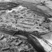
SC 1720915 |
Chapelton, oblique aerial view, taken from the NW |
1995 |
Item Level |
 |
On-line Digital Images |
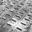
SC 1875779 |
Aerial view of the Nobel's explosive works, Ardeer |
4/9/1995 |
Item Level |
 |
On-line Digital Images |
SC 1875780 |
Aerial view of the Nobel's explosive works, Ardeer. |
4/9/1995 |
Item Level |
 |
On-line Digital Images |
SC 1875781 |
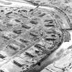
Aerial view of the Nobel's explosive works, Ardeer. |
4/9/1995 |
Item Level |
 |
On-line Digital Images |
SC 1859717 |
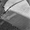
Oblique aerial view of the cropmarks of the ring ditch, looking SSW. |
21/7/1995 |
Item Level |
 |
On-line Digital Images |
SC 1859718 |
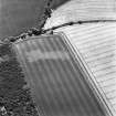
Oblique aerial view of the cropmarks of the ring ditch, looking S. |
21/7/1995 |
Item Level |


