551 178/1/37
Description Sortie 2011/37
Collection RCAHMS Aerial Photography Digital
Catalogue Number 551 178/1/37
Category All Other
Permalink http://canmore.org.uk/collection/1255341
Collection Hierarchy - Sub-Group Level
Collection Level (551 178) RCAHMS Aerial Photography Digital
> Sub-Group Level (551 178/1) 2011 Photographs
>> Sub-Group Level (551 178/1/37) Sortie 2011/37
| Preview | Category | Catalogue Number | Title | Date | Level |
|---|---|---|---|---|---|
 |
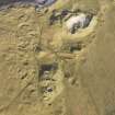
On-line Digital Images | DP 111339 | Oblique aerial view of the remains of a system of fish traps at Oronsay, North Uist, taken from the SW. | 16/11/2011 | Item Level |
 |
On-line Digital Images | DP 111336 | Oblique aerial view of the remains of the settlement at the Udal, North Uist, taken from the SSW. | 16/11/2011 | Item Level |
 |
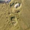
On-line Digital Images | DP 111340 | Oblique aerial view of the remains of a causeway and possible fish trap at Oronsay and the adjacent remains of a farmstead, Oronsay, North Uist, taken from the WSW. | 16/11/2011 | Item Level |
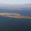 |
On-line Digital Images | DP 111337 | General oblique aerial view of the Isle of Boreray, looking towards Pabbay, taken from the SSW. | 16/11/2011 | Item Level |
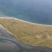 |
On-line Digital Images | DP 111341 | General oblique aerial view of Machair Robach and Vallaquie, North Uist, taken from the SSE. | 16/11/2011 | Item Level |
 |
On-line Digital Images | DP 111335 | Oblique aerial view of the remains of the settlement at the Udal, North Uist, taken from the SSW. | 16/11/2011 | Item Level |
 |
On-line Digital Images | DP 111338 | General oblique aerial view of Lingeigh, the Sound of Berneray and the Isle of Berneray, taken from the WSW. | 16/11/2011 | Item Level |
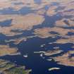 |
On-line Digital Images | DP 111346 | General oblique aerial view of Loch an Duin and the location of the remains of two duns and a broch, North Uist, taken from the SSW. | 16/11/2011 | Item Level |
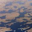 |
On-line Digital Images | DP 111345 | General oblique aerial view of Loch an Duin and the location of the remains of a broch and a dun, North Uist, taken from the SSW. | 16/11/2011 | Item Level |
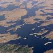 |
On-line Digital Images | DP 111343 | General oblique aerial view of Loch an Duin and the location of the remains of the duns and broch, North Uist, taken from the SSW. | 16/11/2011 | Item Level |
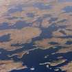 |
On-line Digital Images | DP 111344 | General oblique aerial view of Loch an Duin and the location of the remains of the duns and broch, North Uist, taken from the SSW. | 16/11/2011 | Item Level |
 |
On-line Digital Images | DP 111347 | General oblique aerial view of the remains of the township of Brae-Callasay, North Uist, taken from the SSW. | 16/11/2011 | Item Level |
 |
On-line Digital Images | DP 111356 | Oblique aerial view of the remains of the townships of Upper and Lower Halistra and Peinstaphen, with the remains of adjacent dykes, enclosures and lazy beds, Waternish, Skye, taken from the SW. | 16/11/2011 | Item Level |
 |
On-line Digital Images | DP 111357 | Oblique aerial view of the remains of the Dun Hallin broch and the township of Dunhallin, with the remains of the adjacent field system, enclosuires and lazy beds, Waternish, Skye, taken from the SW. | 16/11/2011 | Item Level |
 |
On-line Digital Images | DP 111358 | Oblique aerial view of the remains of the Dun Hallin broch and the township of Dunhallin, with the remains of the adjacent field system, enclosuires and lazy beds, Waternish, Skye, taken from the SW. | 16/11/2011 | Item Level |
 |
On-line Digital Images | DP 111360 | General oblique aerial view of Knott, Edinbane and Loch Snizort Beag, Skye, taken from the W. | 16/11/2011 | Item Level |
 |
On-line Digital Images | DP 111359 | General oblique aerial view of the wind farm at Edinbane and the Waternish peninsula, looking toward the Cuillin hills, Skye, taken from the SW. | 16/11/2011 | Item Level |
 |
On-line Digital Images | DP 111348 | General oblique aerial view of the remains of the township of Brae-Callasay, North Uist, taken from the SSW. | 16/11/2011 | Item Level |
 |
On-line Digital Images | DP 111351 | General oblique aerial view of the remains of the townships of Trumpan Mor, Trumpan Beg and the remains of the surrounding dykes and lazy beds, Waternish, Skye, taken from the SW. | 16/11/2011 | Item Level |
 |
On-line Digital Images | DP 111352 | General oblique aerial view of the remains of the townships of Trumpan Mor, Trumpan Beg and the remains of the surrounding dykes and lazy beds, Waternish, Skye, taken from the SW. | 16/11/2011 | Item Level |
 |
On-line Digital Images | DP 111353 | General oblique aerial view of the remains of the eastern end of Trumpan Mor and the western end of the townships of Upper and Lower Halistra, with the remains of adjacent dykes, enclosures and lazy beds, Waternish, Skye, taken from the SW. | 16/11/2011 | Item Level |
 |
On-line Digital Images | DP 111354 | General oblique aerial view of the remains of the eastern end of Trumpan Mor and the western end of the townships of Upper and Lower Halistra, with the remains of adjacent dykes, enclosures and lazy beds, Waternish, Skye, taken from the SW. | 16/11/2011 | Item Level |
 |
On-line Digital Images | DP 111349 | General oblique aerial view of Rubha an Duine, near Lochmaddy, looking towards Hermetray and Vallasay, North Uist, taken from the SW. | 16/11/2011 | Item Level |
 |
On-line Digital Images | DP 111355 | Oblique aerial view of the remains of the eastern end of Trumpan Mor and the western end of the townships of Upper and Lower Halistra, with the remains of adjacent dykes, enclosures and lazy beds, Waternish, Skye, taken from the SW. | 16/11/2011 | Item Level |


