|
Digital Files (Non-image) |
TM 000994 |
GPS recorded flight path and map for Sortie 2009/46 |
6/8/2009 |
Item Level |
 |
On-line Digital Images |
DP 066519 |
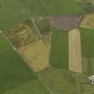
Oblique aerial view centred on the cropmarks of the enclosure at Quaquoy, taken from the NNW. |
6/8/2009 |
Item Level |
 |
On-line Digital Images |
DP 066520 |
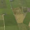
Oblique aerial view centred on the cropmarks of the enclosure at Quaquoy, taken from the WNW. |
6/8/2009 |
Item Level |
 |
On-line Digital Images |
DP 066521 |
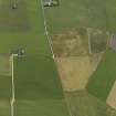
Oblique aerial view centred on the cropmarks of the enclosure at Quaquoy, taken from the W. |
6/8/2009 |
Item Level |
 |
On-line Digital Images |
DP 068736 |
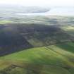
General oblique view of Wideford Hill with the Scapa Bay beyond, taken from the NW. |
6/8/2009 |
Item Level |
 |
On-line Digital Images |
DP 068737 |
Oblique aerial view centred on Cursiter sandstone quarry, taken from the N. |
6/8/2009 |
Item Level |
 |
On-line Digital Images |
DP 068738 |
Oblique aerial view centred on Cursiter sandstone quarry, taken from the N. |
6/8/2009 |
Item Level |
 |
On-line Digital Images |
DP 068739 |
Oblique aerial view centred on Cursiter sandstone quarry, taken from the NNW. |
6/8/2009 |
Item Level |
 |
On-line Digital Images |
DP 068745 |
General oblique aerial view of the Loch of Stenness with Maes Howe in the foreground and Hoy in the distance, taken from the NE. |
6/8/2009 |
Item Level |
 |
On-line Digital Images |
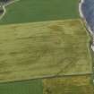
DP 068836 |
Oblique aerial view centred on the cropmarks of the broch at Bu, taken from the W. |
6/8/2009 |
Item Level |
 |
On-line Digital Images |
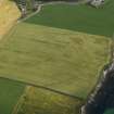
DP 068838 |
Oblique aerial view centred on the cropmarks of the broch at Bu, taken from the SW. |
6/8/2009 |
Item Level |
 |
On-line Digital Images |
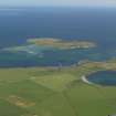
DP 083404 |
General oblique aerial view of Whitehall, Stronsay with Papa Stronsay beyond, taken from the SW. |
6/8/2009 |
Item Level |
 |
On-line Digital Images |
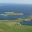
DP 083405 |
General oblique aerial view of Whitehall, Stronsay with Papa Stronsay beyond, taken from the SW. |
6/8/2009 |
Item Level |
 |
On-line Digital Images |
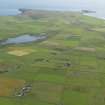
DP 083406 |
General oblique aerial view looking towards the SW end of Stronsay to Lamb Head with Meikle Water to the left, taken from the NE. |
6/8/2009 |
Item Level |
 |
On-line Digital Images |
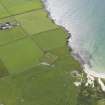
DP 083407 |
Oblique aerial view centred on Lady Kirk church and burial ground, taken from the NW. |
6/8/2009 |
Item Level |
 |
On-line Digital Images |
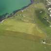
DP 083408 |
Oblique aerial view centred on the cropmarks of rig and furrow, taken from the WSW. |
6/8/2009 |
Item Level |
 |
On-line Digital Images |
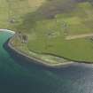
DP 083409 |
Oblique aerial view centred on Longbigging farmstead with feeder bin stances visible on the shoreline adjacent, taken from the NW. |
6/8/2009 |
Item Level |
 |
On-line Digital Images |
DP 083410 |
Oblique aerial view centred on Longbigging farmstead with feeder bin stances visible on the shoreline adjacent, taken from the NW. |
6/8/2009 |
Item Level |
 |
On-line Digital Images |
DP 083411 |
Kevin Macleod (RCAHMS Aerial Survey Mapping Manager) on the apron at Kirkwall during RCAHMS aerial survey. |
6/8/2009 |
Item Level |
 |
On-line Digital Images |
DP 083412 |
General oblique aerial view of the Old Man of Hoy, taken from the SSE. |
6/8/2009 |
Item Level |
 |
On-line Digital Images |
DP 083413 |
General oblique aerial view of the Old Man of Hoy, taken from the SSE. |
6/8/2009 |
Item Level |
 |
On-line Digital Images |
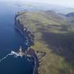
DP 083414 |
General oblique aerial view of the Old Man of Hoy with the Kame of Hoy beyond, taken from the S. |
6/8/2009 |
Item Level |
 |
On-line Digital Images |
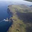
DP 083415 |
General oblique aerial view of the Old Man of Hoy with the Kame of Hoy beyond, taken from the S. |
6/8/2009 |
Item Level |
 |
On-line Digital Images |
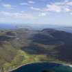
DP 083416 |
General oblique aerial view looking over Rackwick Bay towards the village of Rackwick, taken from the SW. |
6/8/2009 |
Item Level |


