|
Digital Files (Non-image) |
TM 000971 |
GPS recorded flight path and map for Sortie 2009/14 |
12/5/2009 |
Item Level |
 |
On-line Digital Images |
DP 059711 |
Oblique aerial view centred on the remains of a stone sheepfold at Myres, taken from the NNE. |
12/5/2009 |
Item Level |
 |
On-line Digital Images |
DP 059712 |
Oblique aerial view centred on the remains of the farmsteads at Hillycliff, taken from the SW. |
12/5/2009 |
Item Level |
 |
On-line Digital Images |
DP 059713 |
Oblique aerial view centred on the remains of the farmsteads at Hillycliff, taken from the ESE. |
12/5/2009 |
Item Level |
 |
On-line Digital Images |
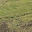
DP 059714 |
Oblique aerial view centred on the remains of a farmstead at Hillycliff, taken from the NE. |
12/5/2009 |
Item Level |
 |
On-line Digital Images |
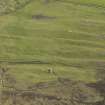
DP 059715 |
Oblique aerial view centred on the remains of three farmsteads at Hillycliff, taken from the NE. |
12/5/2009 |
Item Level |
 |
On-line Digital Images |
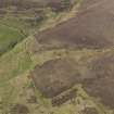
DP 059716 |
Oblique aerial view centred on the remains of the farmsteads at Hillycliff, taken from the NE. |
12/5/2009 |
Item Level |
 |
On-line Digital Images |
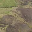
DP 059717 |
Oblique aerial view centred on the remains of a farmstead and sheepfold at Flanders Moss, taken from the SSW. |
12/5/2009 |
Item Level |
 |
On-line Digital Images |
DP 059718 |
Oblique aerial view centred on the remains of a farmstead and sheepfold at Flanders Moss, taken from the S. |
12/5/2009 |
Item Level |
 |
On-line Digital Images |
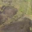
DP 059719 |
Oblique aerial view centred on the remains of a farmstead and sheepfold at Flanders Moss, taken from the E. |
12/5/2009 |
Item Level |
 |
On-line Digital Images |
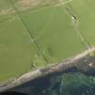
DP 059720 |
Oblique aerial view centred on the possible broch at Knowe of Hunclett with the remains of a farmstead adjacent, taken from the SW. |
12/5/2009 |
Item Level |
 |
On-line Digital Images |
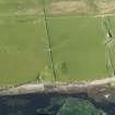
DP 059721 |
Oblique aerial view centred on the possible broch at Knowe of Hunclett with the remains of a farmstead adjacent, taken from the S. |
12/5/2009 |
Item Level |
 |
On-line Digital Images |
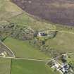
DP 059722 |
Oblique aerial view centred on Trumland House, taken from the SSE. |
12/5/2009 |
Item Level |
 |
On-line Digital Images |
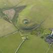
DP 059723 |
Oblique aerial view centred on Cubbie Roo's Castle with St Mary's Chapel and The Bu farmstead adjacent, taken from the E. |
12/5/2009 |
Item Level |
 |
On-line Digital Images |
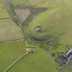
DP 059724 |
Oblique aerial view centred on Cubbie Roo's Castle with St Mary's Chapel and The Bu farmstead adjacent, taken from the NE. |
12/5/2009 |
Item Level |
 |
On-line Digital Images |
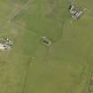
DP 059725 |
Oblique aerial view centred on St Magnus' Church and burial ground, taken from the NW. |
12/5/2009 |
Item Level |
 |
On-line Digital Images |
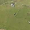
DP 059726 |
Oblique aerial view centred on St Magnus' Church and burial ground, taken from the WSW. |
12/5/2009 |
Item Level |
 |
On-line Digital Images |
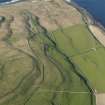
DP 059727 |
Oblique aerial view centred on the the remains of enclosures and field boundaries at Faraclett Head with a cairn adjacent, taken from the SW. |
12/5/2009 |
Item Level |
 |
On-line Digital Images |
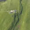
DP 059728 |
Oblique aerial view centred on the burial ground at Scockness with Scockness Farm adjacent, taken from the S. |
12/5/2009 |
Item Level |
 |
On-line Digital Images |
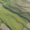
DP 059729 |
Oblique aerial view centred on the the remains of enclosures and field boundaries at Faraclett Head with a cairn adjacent, taken from the NE. |
12/5/2009 |
Item Level |
 |
On-line Digital Images |
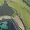
DP 059730 |
Oblique aerial view centred on the possible broch at Scockness with the Loch of Scockness adjacent, taken from the NNE. |
12/5/2009 |
Item Level |
 |
On-line Digital Images |
DP 059731 |
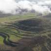
General oblique aerial view of the tabular geology of Kierfea Hill, Rousay, taken from the NNE. |
12/5/2009 |
Item Level |
 |
On-line Digital Images |
DP 059732 |
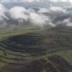
General oblique aerial view of the tabular geology of Kierfea Hill, Rousay, taken from the NNE. |
12/5/2009 |
Item Level |
 |
On-line Digital Images |
DP 059733 |
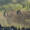
General oblique aerial view of the tabular geology on the lower slopes of Kierfea Hill, Rousay, taken from the N. |
12/5/2009 |
Item Level |


