Sortie 2010/31
551 178/3/31
Description Sortie 2010/31
Collection RCAHMS Aerial Photography Digital
Catalogue Number 551 178/3/31
Category All Other
Permalink http://canmore.org.uk/collection/1237043
Description Sortie 2010/31
Collection RCAHMS Aerial Photography Digital
Catalogue Number 551 178/3/31
Category All Other
Permalink http://canmore.org.uk/collection/1237043
Collection Level (551 178) RCAHMS Aerial Photography Digital
> Sub-Group Level (551 178/3) 2010 Photographs
>> Sub-Group Level (551 178/3/31) Sortie 2010/31
| Preview | Category | Catalogue Number | Title | Date | Level |
|---|---|---|---|---|---|
| Digital Files (Non-image) | TM 000945 | GPS recorded flight path and map for Sortie 2010/31 | 13/7/2010 | Item Level | |
 |
On-line Digital Images | DP 091284 | General oblique aerial view of the cropmarks with Drumtogle in the foreground and Haugh of Aberuthven in the distance, looking to the NE. | 13/7/2010 | Item Level |
 |
On-line Digital Images | DP 091285 | General oblique aerial view of the cropmarks with Drumtogle in the foreground and Haugh of Aberuthven in the distance, looking to the NNE. | 13/7/2010 | Item Level |
 |
On-line Digital Images | DP 091286 | Oblique aerial view of the cropmarks of the rig, looking to the NE. | 13/7/2010 | Item Level |
 |
On-line Digital Images | DP 091287 | Oblique aerial view of the cropmarks of the rig, looking to the NNE. | 13/7/2010 | Item Level |
 |
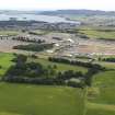
On-line Digital Images | DP 091290 | General oblique aerial view of T in the Park with Loch Leven beyond, looking to the ESE. | 13/7/2010 | Item Level |
 |
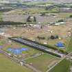
On-line Digital Images | DP 091292 | Oblique aerial view of T in the Park, looking to the E. | 13/7/2010 | Item Level |
 |
On-line Digital Images | DP 091297 | Oblique aerial view of the cropmarks of the possible ring ditch house and pits, looking to the NW. | 13/7/2010 | Item Level |
 |
On-line Digital Images | DP 091298 | Oblique aerial view of the cropmarks of the possible ring ditch house and pits, looking to the S. | 13/7/2010 | Item Level |
 |
On-line Digital Images | DP 091301 | Oblique aerial view of the cropmarks of the enclosure, looking to the E. | 13/7/2010 | Item Level |
 |
On-line Digital Images | DP 091302 | Oblique aerial view of the cropmarks of the possible enclosure, looking to the W. | 13/7/2010 | Item Level |
 |
On-line Digital Images | DP 091303 | Oblique aerial view of the cropmarks of the possible enclosure, looking to the WSW. | 13/7/2010 | Item Level |
 |
On-line Digital Images | DP 091305 | Oblique aerial view of the cropmarks of the pits with the excavation and Doune Castle adjacent, looking to the NW. | 13/7/2010 | Item Level |
 |
On-line Digital Images | DP 091307 | Oblique aerial view of the cropmarks of the pits with the excavation adjacent, looking to the WSW. | 13/7/2010 | Item Level |
 |
On-line Digital Images | DP 091308 | Oblique aerial view of the cropmarks of the pits with the excavation adjacent, looking to the SSW. | 13/7/2010 | Item Level |
 |
On-line Digital Images | DP 091257 | Oblique aerial view of the cropmarks of the rig, looking to the ESE. | 13/7/2010 | Item Level |
 |
On-line Digital Images | DP 091258 | Oblique aerial view of the cropmarks of the barrow, field boundary and drains, taken from the SW. | 13/7/2010 | Item Level |
 |
On-line Digital Images | DP 091259 | Oblique aerial view of the cropmarks of the barrow, field boundary and drains, taken from the SSW. | 13/7/2010 | Item Level |
 |
On-line Digital Images | DP 091260 | Oblique aerial view of the cropmarks of the possible enclosure and the field boundary, looking to the SE. | 13/7/2010 | Item Level |
 |
On-line Digital Images | DP 091261 | Oblique aerial view of the cropmarks of the possible enclosure and the field boundary, looking to the ESE. | 13/7/2010 | Item Level |
 |
On-line Digital Images | DP 091262 | Oblique aerial view of the cropmarks of the field boundaries with Quochag farmsteading adjacent, looking to the NE. | 13/7/2010 | Item Level |
 |
On-line Digital Images | DP 091263 | Oblique aerial view of the cropmarks of the possible enclosure and the field boundary, looking to the NNE. | 13/7/2010 | Item Level |
 |
On-line Digital Images | DP 091264 | Oblique aerial view of the cropmarks of the possible enclosure and the field boundary, looking to the W. | 13/7/2010 | Item Level |
 |
On-line Digital Images | DP 091265 | Oblique aerial view of the cropmarks of the possible enclosure and the field boundary, looking to the WSW. | 13/7/2010 | Item Level |

© Historic Environment Scotland. Scottish Charity No. SC045925