|
Digital Files (Non-image) |
TM 000942 |
GPS recorded flight path and map for Sortie 2010/28 |
6/7/2010 |
Item Level |
 |
On-line Digital Images |
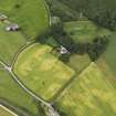
DP 090777 |
Oblique aerial view of the cropmarks of the track with Manse adjacent, taken from the S. |
6/7/2010 |
Item Level |
 |
On-line Digital Images |
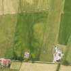
DP 090780 |
Oblique aerial view of the cropmarks of the possible barrows, taken from the E. |
6/7/2010 |
Item Level |
 |
On-line Digital Images |
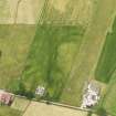
DP 090781 |
Oblique aerial view of the cropmarks of the possible barrows, taken from the ENE. |
6/7/2010 |
Item Level |
 |
On-line Digital Images |
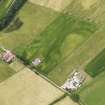
DP 090782 |
Oblique aerial view of the cropmarks of the possible barrows, taken from the NE. |
6/7/2010 |
Item Level |
 |
On-line Digital Images |
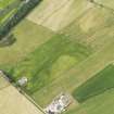
DP 090783 |
Oblique aerial view of the cropmarks of the possible barrows, taken from the NNE. |
6/7/2010 |
Item Level |
 |
On-line Digital Images |
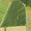
DP 090784 |
Oblique aerial view of the cropmarks of the field boundaries, taken from the SSW. |
6/7/2010 |
Item Level |
 |
On-line Digital Images |
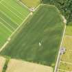
DP 090785 |
Oblique aerial view of the cropmarks of the field boundaries, taken from the S. |
6/7/2010 |
Item Level |
 |
On-line Digital Images |
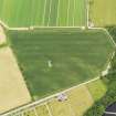
DP 090786 |
Oblique aerial view of the cropmarks of the field boundaries, taken from the SE. |
6/7/2010 |
Item Level |
 |
On-line Digital Images |
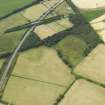
DP 090787 |
Oblique aerial view of the cropmarks of the field boundaries, taken from the ENE. |
6/7/2010 |
Item Level |
 |
On-line Digital Images |
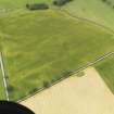
DP 090788 |
Oblique aerial view of the cropmarks of the ring ditch, taken from the ESE. |
6/7/2010 |
Item Level |
 |
On-line Digital Images |
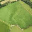
DP 090789 |
Oblique aerial view of the cropmarks of the enclosure, taken from the NNW. |
6/7/2010 |
Item Level |
 |
On-line Digital Images |
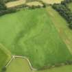
DP 090790 |
Oblique aerial view of the cropmarks of the enclosure, taken from the WNW. |
6/7/2010 |
Item Level |
 |
On-line Digital Images |
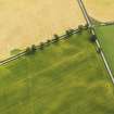
DP 090791 |
Oblique aerial view of the cropmarks of the ring ditch, taken from the NW. |
6/7/2010 |
Item Level |
 |
On-line Digital Images |
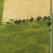
DP 090792 |
Oblique aerial view of the cropmarks of the ring ditch, taken from the WNW. |
6/7/2010 |
Item Level |
 |
On-line Digital Images |
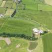
DP 090793 |
Oblique aerial view of the cropmarks of the fort and Greenhillhead Farm, taken from the ENE. |
6/7/2010 |
Item Level |
 |
On-line Digital Images |
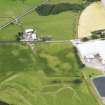
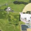
DP 090794 |
Oblique aerial view of the cropmarks of the barrow and possible field boundary with Priestdykes farmstead beyond, taken from the E. |
6/7/2010 |
Item Level |
 |
On-line Digital Images |
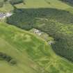
DP 090795 |
Oblique aerial view of the cropmarks of the barrow and possible field boundary with Priestdykes farmstead beyond, taken from the ENE. |
6/7/2010 |
Item Level |
 |
On-line Digital Images |
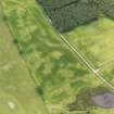
DP 090796 |
Oblique aerial view of the cropmarks of the pits and ditch, taken from the NE. |
6/7/2010 |
Item Level |
 |
On-line Digital Images |
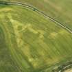
DP 090797 |
Oblique aerial view of the cropmarks of the pits and ditch, taken from the NNE. |
6/7/2010 |
Item Level |
 |
On-line Digital Images |
DP 090798 |
Oblique aerial view of the cropmarks of the rectilinear settlement and the ditch of the Roman Temporary Camp at Torwood, taken from the SW. |
6/7/2010 |
Item Level |
 |
On-line Digital Images |
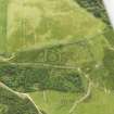
DP 090751 |
Oblique aerial view of the remains of Trowdale Mote, taken from the NW. |
6/7/2010 |
Item Level |
 |
On-line Digital Images |
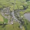
DP 090753 |
General oblique aerial view of Crossmichael Village, taken from the NNW. |
6/7/2010 |
Item Level |
 |
On-line Digital Images |
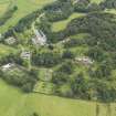
DP 090754 |
General oblique aerial view of Threave House and gardens, taken from the SW. |
6/7/2010 |
Item Level |


