551 178/3/12
Description Sortie 2010/12
Collection RCAHMS Aerial Photography Digital
Catalogue Number 551 178/3/12
Category All Other
Permalink http://canmore.org.uk/collection/1237024
Collection Hierarchy - Sub-Group Level
Collection Level (551 178) RCAHMS Aerial Photography Digital
> Sub-Group Level (551 178/3) 2010 Photographs
>> Sub-Group Level (551 178/3/12) Sortie 2010/12
| Preview | Category | Catalogue Number | Title | Date | Level |
|---|---|---|---|---|---|
 |
On-line Digital Images | DP 088802 | General oblique aerial view of Alva, centred on Parkgate, Caroline Crescent, Dalmore Drive, Carnaughton Place, St Serf's Walk, Craighorn Road, The Nibet, Cleuch Drive, Torry Drive, The Broich, Grodwell Drive, Cochrane Crescent, Wharry Road and Glenwhinnel Road, taken from the W | 26/4/2010 | Item Level |
 |
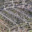
On-line Digital Images | DP 088803 | General oblique aerial view of Alva, centred on Parkgate, Caroline Crescent, Dalmore Drive, Carnaughton Place, St Serf's Walk, Craighorn Road, The Nibet, Cleuch Drive, Torry Drive, The Broich, Grodwell Drive, Cochrane Crescent, Wharry Road and Glenwhinnel Road, taken from the E | 26/4/2010 | Item Level |
 |
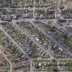
On-line Digital Images | DP 088804 | General oblique aerial view of Tillicoultry, centred on area between High Street and Walker Terrace, comprising Stirling Street, Ochil Street, Hamilton Street and Hill Street, taken from the N | 26/4/2010 | Item Level |
 |
On-line Digital Images | DP 088805 | General oblique aerial view of Tillicoultry, centred on area between High Street and Walker Terrace, comprising Stirling Street, Ochil Street, Hamilton Street and Hill Street, taken from the N | 26/4/2010 | Item Level |
 |
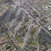
On-line Digital Images | DP 088806 | General oblique aerial view of Tillicoultry, centred on Paton's Mill, taken from the N | 26/4/2010 | Item Level |
 |
On-line Digital Images | DP 088807 | General oblique aerial view of Tillicoultry, centred on area between High Street and Walker Terrace, comprising Stirling Street, Ochil Street, Hamilton Street and Hill Street, taken from the W | 26/4/2010 | Item Level |
 |
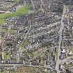
On-line Digital Images | DP 088808 | General oblique aerial view of Tillicoultry, centred on area between Walker Terrace and Jamieson Gardens, taken from the W | 26/4/2010 | Item Level |
 |
On-line Digital Images | DP 088809 | General oblique aerial view of Tillicoultry, centred on area between High Street and Jamieson Gardens, comprising Stirling Street, Ochil Street, Hamilton Street and Hill Street, taken from the W | 26/4/2010 | Item Level |
 |
On-line Digital Images | DP 088810 | General oblique aerial view of Tillicoultry, centred on Hareburn Road, with Paton's Mill to left, taken from the W | 26/4/2010 | Item Level |
 |
On-line Digital Images | DP 088811 | General oblique aerial view of Tillicoultry, centred on Hareburn Road and Paton's Mill, taken from the SW | 26/4/2010 | Item Level |
 |
On-line Digital Images | DP 088812 | General oblique aerial view of Tillicoultry, centred on Hareburn Road and Paton's Mill, taken from the SW | 26/4/2010 | Item Level |
 |
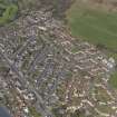
On-line Digital Images | DP 088813 | General oblique aerial view of Tillicoultry, centred on Hareburn Road and Paton's Mill, with Oak Mill to bottom left, taken from the SW | 26/4/2010 | Item Level |
 |
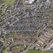
On-line Digital Images | DP 088814 | General oblique aerial view of Tillicoultry, centred on area between High Street and Jamieson Gardens, comprising Stirling Street, Ochil Street, Hamilton Street and Hill Street, taken from the SE | 26/4/2010 | Item Level |
 |
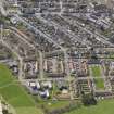
On-line Digital Images | DP 088815 | General oblique aerial view of Tillicoultry, centred on area between High Street and Jamieson Gardens, comprising Stirling Street, Ochil Street, Hamilton Street and Hill Street, taken from the NE | 26/4/2010 | Item Level |
 |
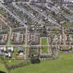
On-line Digital Images | DP 088816 | General oblique aerial view of Tillicoultry, centred on area between High Street and Jamieson Gardens, comprising Stirling Street, Ochil Street, Hamilton Street and Hill Street, taken from the N | 26/4/2010 | Item Level |
 |
On-line Digital Images | DP 088817 | General oblique aerial view of Tillicoultry, centred on area between High Street and Jamieson Gardens, comprising Stirling Street, Ochil Street, Hamilton Street and Hill Street, taken from the N | 26/4/2010 | Item Level |
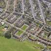 |
On-line Digital Images | DP 088818 | General oblique aerial view of Tillicoultry, centred on area between High Street and Jamieson Gardens, comprising Stirling Street, Ochil Street, Hamilton Street and Hill Street, taken from the NW | 26/4/2010 | Item Level |
 |
On-line Digital Images | DP 088819 | General oblique aerial view of Tillicoultry, centred on area between Jamieson Gardens and Walker Terrace, taken from the W | 26/4/2010 | Item Level |
 |
On-line Digital Images | DP 088820 | General oblique aerial view of Tillicoultry, centred on area between Jamieson Gardens and Walker Terrace, taken from the W | 26/4/2010 | Item Level |
 |
On-line Digital Images | DP 088821 | General oblique aerial view of Tillicoultry, centred on area between Jamieson Gardens and Walker Terrace, taken from the SW | 26/4/2010 | Item Level |
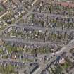 |
On-line Digital Images | DP 088822 | General oblique aerial view of Tillicoultry, centred on area between High Street and Walker Terrace, comprising Stirling Street, Ochil Street, Hamilton Street and Hill Street, taken from the SW | 26/4/2010 | Item Level |
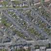 |
On-line Digital Images | DP 088823 | General oblique aerial view of Tillicoultry, centred on area between High Street and Walker Terrace, comprising Stirling Street, Ochil Street, Hamilton Street and Hill Street, taken from the S | 26/4/2010 | Item Level |
 |
On-line Digital Images | DP 088824 | General oblique aerial view of Tillicoultry, centred on Tillicoultry Primary School and Kirk Hill area, taken from the NE | 26/4/2010 | Item Level |
 |
On-line Digital Images | DP 088825 | General oblique aerial view of Tillicoultry, centred on Tillicoultry Primary School and Kirk Hill area, taken from the NW | 26/4/2010 | Item Level |


