|
Digital Files (Non-image) |
GV 005146 |
Plan of Dun Burgidale, undertaken with local volunteers. |
30/9/2010 |
Item Level |
|
Digital Files (Non-image) |
TM 000066 |
ZIP file containing the TIF and TFW source files required to georeferenced RCAHMS St Blane's measured survey drawing. |
4/12/2013 |
Item Level |
|
Digital Files (Non-image) |
GV 007658 |
Plan of Ardnahoe fort |
2020 |
Item Level |
|
Digital Files (Non-image) |
TM 001983 |
RCAHMS, Isle of Bute Survey - GNSS data, CAD files and metadata form |
12/2008 |
Item Level |
|
Digital Files (Non-image) |
GV 009001 |
Plans, section and elevation of Kilchattan Lime Kiln. Unpublished illustration. |
2020 |
Item Level |
|
Digital Files (Non-image) |
GV 009002 |
Dun Burgidale plan, unpublished illustration. |
2020 |
Item Level |
|
Digital Files (Non-image) |
GV 009004 |
Leightan farmstead, plan. Unpublished illustration. |
2020 |
Item Level |
|
Digital Files (Non-image) |
GV 009005 |
Muclich Hill shieling huts, plan. Unpublished illustration. |
2020 |
Item Level |
 |
On-line Digital Images |
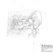
SC 1231879 |
RCAHMS survey drawing; plan of the fort and farmstead at Little Dunagoil.
|
17/3/2010 |
Item Level |
 |
On-line Digital Images |
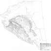
SC 1231881 |
RCAHMS survey drawing; plan of the fort and its environs at Dunagoil.
|
17/3/2010 |
Item Level |
 |
On-line Digital Images |
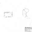
SC 1231916 |
RCAHMS survey drawing; plan and location plan of Kilchousland Chapel. |
15/3/2010 |
Item Level |
 |
On-line Digital Images |
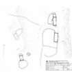
SC 1231918 |
RCAHMS survey drawing; plan of Ardnagave farmstead. |
16/3/2010 |
Item Level |
 |
On-line Digital Images |
SC 1231930 |
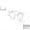
RCAHMS publication drawing; plan and elevation of Ascog salt pans.
|
19/3/2010 |
Item Level |
 |
On-line Digital Images |
SC 1231932 |
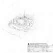
RCAHMS survey drawing; Plan of Dun Scalpsie. |
16/3/2010 |
Item Level |
 |
On-line Digital Images |
SC 1231934 |
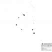
RCAHMS survey drawing; Plan of Colmac Stone Circle. |
15/3/2010 |
Item Level |
 |
On-line Digital Images |
SC 1231936 |
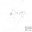
RCAHMS survey drawing; plan of Stuck farmstead. |
18/3/2010 |
Item Level |
 |
On-line Digital Images |
SC 1231938 |
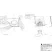
RCAHMS survey drawing; Plans, section and elevation of Kilchattan Lime Kiln. |
30/3/2010 |
Item Level |
 |
On-line Digital Images |
SC 1231940 |
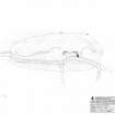
RCAHMS survey drawing; plan of Bicker's Houses Chambered Cairn. |
30/3/2010 |
Item Level |
 |
On-line Digital Images |
SC 1231942 |
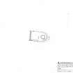
RCAHMS survey drawing; plan of Ardmaleish Kiln Barn. |
31/3/2010 |
Item Level |
 |
On-line Digital Images |
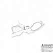
SC 1231949 |
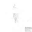
RCAHMS survey drawing; plan and section of rock shelter at Dunagoil. |
29/3/2010 |
Item Level |
 |
On-line Digital Images |
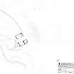
SC 1231951 |
RCAHMS survey drawing; plan of building and enclosures at Butt a Croit, undertaken with local volunteers. |
29/9/2010 |
Item Level |
 |
On-line Digital Images |
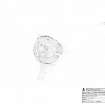
SC 1231953 |
RCAHMS survey drawing; plan of the farmstead at Achavoulaig Butt, undertaken with local volunteers. |
28/9/2010 |
Item Level |
 |
On-line Digital Images |
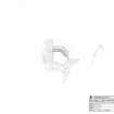
SC 1231955 |
RCAHMS survey drawing; Plan of Dun Burgidale, undertaken with local volunteers. |
30/9/2010 |
Item Level |
 |
On-line Digital Images |
SC 1231957 |
RCAHMS survey drawing; Plan of Ardnahoe fort. |
1/10/2010 |
Item Level |


