|
Digital Files (Non-image) |
GV 005065 |
Publication drawing; plan of Lenihall Farmstead |
2012 |
Item Level |
|
Digital Files (Non-image) |
GV 005066 |
Publication drawing; plan of Barefield farmstead |
2012 |
Item Level |
|
Digital Files (Non-image) |
GV 005067 |
Publication drawing; plan of Kirk Dam |
2012 |
Item Level |
|
Digital Files (Non-image) |
GV 005068 |
Publication drawing; plans and section of Ascog salt pan |
2012 |
Item Level |
|
Digital Files (Non-image) |
GV 005075 |
Publication drawing; plan of Leightan farmstead |
2012 |
Item Level |
 |
On-line Digital Images |
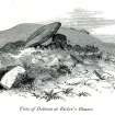
SC 1163929 |
View of dolmen (Hewison 1893, 65). |
1869 |
Item Level |
 |
On-line Digital Images |
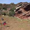
DP 073220 |
General view of cave to W of Hawks Nib, taken from S. |
17/3/2009 |
Item Level |
 |
On-line Digital Images |
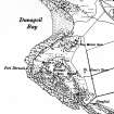
SC 1208177 |
Extract from the 3rd edition of the OS 6-inch map, surveyed in 1915 and published in 1924. |
1924 |
Item Level |
 |
On-line Digital Images |
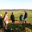
DP 084694 |
View of RCAHMS staff and members of the public, taken from the SW. From left to right: unknown; Isabell Mcarthur, Angus Hannah, Donald Kinnear, Alex Hale (RCAHMS), unknown. |
8/12/2008 |
Item Level |
 |
On-line Digital Images |
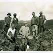
SC 1210134 |
Excavations at Eilean Buidhe dun in August 1936. One of a number of important archive photographs held by Bute Museum, this image shows Dr J N Marshall in the trench flanked by his daughter Dorothy and J Harrison Maxwell, who directed the excavations. The photograph was taken from the SW showing one of the trenches cut through the rampart; the building in the background is the boat house at Caol Ruadh School. © Bute Museum |
8/1936 |
Item Level |
 |
On-line Digital Images |
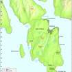
DP 097419 |
Map - The Isle of Bute, showing Rothesay, other settlements and geographical features. |
8/2010 |
Item Level |
 |
On-line Digital Images |
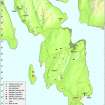
DP 097420 |
Map - Distribution of Mesolithic and Neolithic sites and artefacts. |
8/2010 |
Item Level |
 |
On-line Digital Images |
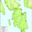
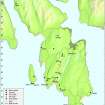
DP 097421 |
Map - Distribution of Early Bronze Age sites and artefacts. |
8/2010 |
Item Level |
 |
On-line Digital Images |
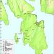
DP 097422 |
Map - Distribution of sites and artefacts of the Late Bronze Age and Iron Age. |
8/2010 |
Item Level |
 |
On-line Digital Images |
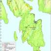
DP 097423 |
Map - Distribution of Early Historic and Medieval sites and artefacts. |
8/2010 |
Item Level |
 |
On-line Digital Images |
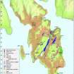
DP 097424 |
Map- Distribution of Pre-Improvement sites and activity. |
8/2010 |
Item Level |
 |
On-line Digital Images |
DP 097425 |
Map - Distribution of Improvement period sites and activilty. |
8/2010 |
Item Level |
 |
On-line Digital Images |
DP 097430 |
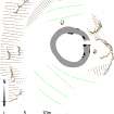
RCAHMS publication illustration; Plan of Barr Hill Hut circle. |
8/2010 |
Item Level |
 |
On-line Digital Images |
DP 097431 |
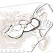
RCAHMS publication drawing; Plan of Little Dunagoil Fort. |
8/2010 |
Item Level |
 |
On-line Digital Images |
DP 097432 |
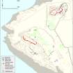
Plan of Dunagoil and Little Dunagoil forts and their environs. |
8/2010 |
Item Level |
 |
On-line Digital Images |
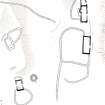
DP 097433 |
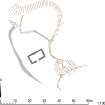
RCAHMS publication illustration; Plan of Kilchousland Chapel |
8/2010 |
Item Level |
 |
On-line Digital Images |
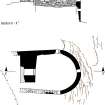
DP 097434 |
RCAHMS publication illustration; Plan of Ardnagave farmstead. |
8/2010 |
Item Level |
 |
On-line Digital Images |
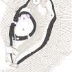
DP 097435 |
RCAHMS publication drawing; Plan and section of Ascog salt pans. |
8/2010 |
Item Level |
 |
On-line Digital Images |
DP 097436 |
RCAHMS publication drawing; Plan of Dun Scalpsie |
8/2010 |
Item Level |


