Accessibility

Font Size

100% 150% 200%

Background Colour

Default Contrast
Close Reset

Ordnance Survey Archaeology Division

551 1/2

Description Ordnance Survey Archaeology Division

Date c. 1940 to 1983

Collection Records of the Royal Commission on the Ancient and Historical Monuments of Scotland (RCAHMS), Edinbu

Catalogue Number 551 1/2

Category All Other

Related Material See also 1/4/26 National Survey Programmes/Ordnance Survey Map Revision/Antiquity Models

Permalink http://canmore.org.uk/collection/1180775

Collection Hierarchy - Group Level

Preview Category Catalogue Number Title Date Level
All Other 551 1/2/2 A collection of miscellaneous material from the former Archaeology Division of the Ordnance Survey Sub-Group Level
All Other 551 1/2/1 Survey of the Antonine Wall 1954 Sub-Group Level
All Other 551 1/2/3 Running Lists Sub-Group Level
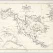
On-line Digital Images On-line Digital Images DP 207928 Ordnance Survey Archaeology Division Record Sheet, preparatory map of archaeological sites. 2/6/1966 Item Level
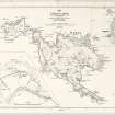
On-line Digital Images On-line Digital Images DP 207929 Map of St Kilda or Hirta and adjacent islands and stacs (1963). Annotated with position of antiquities noted on original. c. 1966 Item Level
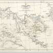
On-line Digital Images On-line Digital Images DP 207930 Ordnance Survey Archaeology Division Field Sheet. Updated with positions and information of archaeological sites. c. 1967 Item Level

People and Organisations

Events