|
Digital Files (Non-image) |
MA 000009 |
AVI file 30 second clip showing a rotating image of the GPS survey information and a colour aerial photograph of Garrywhin Fort draped over the 3D model of the site |
11/2013 |
Item Level |
|
Digital Files (Non-image) |
MA 000010 |
AVI file 20 second clip showing a rotating image of the archaeological features in the area around the Cairn O Get draped over a 3D model of the site |
11/2013 |
Item Level |
|
Digital Files (Non-image) |
MA 000011 |
AVI file 20 second clip showing a rotating image of the archaeological features of Achkinloch (Achavanich) stone setting on a 3D model of the site |
11/2013 |
Item Level |
|
Digital Files (Non-image) |
TM 000062 |
DWG file the GPS survey points taken to create the ground model and footprints of the stones at the Achkinloch stone setting |
11/2004 |
Item Level |
|
Digital Files (Non-image) |
GV 005321 |
RCAHMS colour Adobe Illustrator plan of broch and settlement, scale 1:500, 2004 |
12/2013 |
Item Level |
|
Digital Files (Non-image) |
TM 000067 |
Zip file containing an Arcscene file which which contains all data collected in order to create a 3D illustration of the Garrywhin cairn and stone rows |
12/2013 |
Item Level |
|
Digital Files (Non-image) |
GV 000313 |
DXF file containing GPS survey points collected for Achkinloch Chambered Cairn |
2004 |
Item Level |
|
Digital Files (Non-image) |
DX 001416 |
RCAHMS Field Survey - structures database (Yarrows survey) |
2004 |
Item Level |
|
Digital Files (Non-image) |
Mv 000008 (Duplicate) |
AVI file 40 second clip showing a rotating image of the pencil field drawing of Garrywhin Fort draped over the 3D model of the site |
11/2013 |
Item Level |
|
Digital Files (Non-image) |
TM 000774 |
Zip file containing all survey data collected during the RCAHMS Yarrows survey |
12/2013 |
Item Level |
 |
On-line Digital Images |
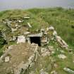
SC 1022096 |
View from W of S side of broch |
28/7/2004 |
Item Level |
 |
On-line Digital Images |
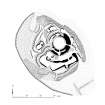
SC 1077776 |
Plan of broch and settlement |
2005 |
Item Level |
 |
On-line Digital Images |
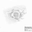
SC 1251045 |
RCAHMS survey drawing: Plan of Watenan Broch. |
26/5/2004 |
Item Level |
 |
On-line Digital Images |
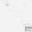
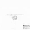
SC 1251046 |
RCAHM survey drawing; Plan of Garrywhin cairn and stone rows |
1/7/2004 |
Item Level |
 |
On-line Digital Images |
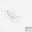
SC 1251047 |
RCAHMS survey drawing; Plan of South Yarrows hut circle. |
9/8/2004 |
Item Level |
 |
On-line Digital Images |
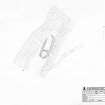
SC 1251048 |
RCAHMS survey drawing; Plan of Sarclet coastal gun battery. |
12/8/2004 |
Item Level |
 |
On-line Digital Images |
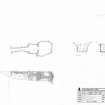
SC 1251074 |
RCAHMS survey drawing; Plan of the Groat's loch building. |
12/8/2004 |
Item Level |
 |
On-line Digital Images |
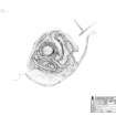
SC 1251085 |
RCAHMS survey drawing; Plan and elevations of the chamber of the Cairn o'Get |
28/7/2004 |
Item Level |
 |
On-line Digital Images |
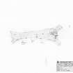
SC 1251086 |
Plan of the Broch of Yarrows. |
28/7/2004 |
Item Level |
 |
On-line Digital Images |
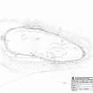
SC 1251087 |
RCAHMS survey drawing; Plan of South Yarrows Long Cairn. |
30/9/2004 |
Item Level |
 |
On-line Digital Images |
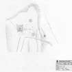
SC 1251103 |
Plan of Garrywhin fort |
30/6/2004 |
Item Level |
 |
On-line Digital Images |
SC 1251104 |
RCAHMS survey drawing; Site plan of the Cairn of Get and surrounding features. |
10/8/2004 |
Item Level |
 |
On-line Digital Images |
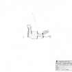
SC 1251105 |
RCAHMS survey drawing; Plan of the chamber of the South Yarrows south cairn. |
5/8/2004 |
Item Level |
 |
On-line Digital Images |
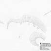
SC 1251106 |
RCAHMS survey drawing; Plan of the Broubster standing stones. |
7/7/2005 |
Item Level |


