 |
On-line Digital Images |
SC 2511266 |
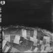
RAF WWII vertical aerial photograph of a section of the coast SW of Crail showing an unidentfied type of military installation at The Coves, Fife. Also visible is Caiplie farmhouse and farmsteading. |
19/6/1941 |
Item Level |
 |
On-line Digital Images |
SC 2552569 |
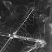
RAF WWII vertical aerial photograph showing the runways during the construction phase.Also visible are areas of anti-landing ditches on the limits of Spey Bay. |
21/2/1943 |
Item Level |
 |
On-line Digital Images |
SC 2487215 |
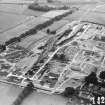
RAF WWII oblique aerial photograph of St Boswells ammunition store. |
4/7/1942 |
Item Level |
 |
On-line Digital Images |
SC 2552570 |
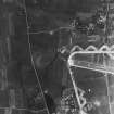
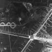
RAF WWII vertical aerial photograph of W part of airfield during the construction phase.Visible are taxiways and part of E-W runway. Also seen on the image is the small village of Nether Dallachy. |
21/2/1943 |
Item Level |
 |
On-line Digital Images |
SC 2552571 |
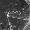
RAF WWII vertical aerial photograph of the main runway crossing point of Dallachy Airfield during the construction phase. Visible are several anti-landing ditches. |
21/2/1943 |
Item Level |
 |
On-line Digital Images |
SC 2552572 |
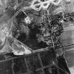
RAF WWII vertical aerial photograph of the NW part of Dallachy Airfield during the construction phase. Visible are part of the main runways, the perimeter track and technical area. Also visible is the small village of Nether Dallachy |
21/2/1943 |
Item Level |
 |
On-line Digital Images |
SC 2552573 |
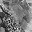
RAF WWII vertical aerial photograph of the NE part of Dallachy Airfield during the construction phase. Visible is part of the perimeter track and taxiways. Also visible is the small village of Nether Dallachy and an area of freshly dug anti-landing ditches to the NE of the village. |
21/2/1943 |
Item Level |
 |
On-line Digital Images |
SC 2513118 |
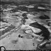
RAF WWII vertical aerial photograph of Leuchars Airfield. Visible are six camouflaged hangars built in the 1920s, part of the runways and four type 27 pillboxes. In the area to the S of the hangars are several differing types of aircraft including Spitfires, Hampdens and Lockheed Lodestars. |
25/9/1942 |
Item Level |
 |
On-line Digital Images |
SC 2499458 |
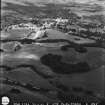
RAF WWII oblique aerial photograph of Carronbridge South Camp. |
26/6/1941 |
Item Level |
 |
On-line Digital Images |
SC 2499459 |
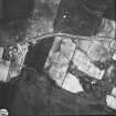
RAF WWII oblique aerial photograph of Carronbridge South Camp. In the background of the photograph, Drumlanrig Castle is also visible. |
26/6/1941 |
Item Level |
 |
On-line Digital Images |
SC 2505040 |
RAF WWII vertical aerial photograph of a heavy anti-aircraft battery at Crossgates near Halbeath, Fife. The four gun emplacements, command position and accommodation camp are visible. |
c. 1941 |
Item Level |
 |
On-line Digital Images |
SC 2510313 |
RAF WWII oblique aerial photograph of Methil and Leven. View west from Leven Links over Leven to Methil Docks.
No.1 CAM oblique |
20/6/1941 |
Item Level |
 |
On-line Digital Images |
SC 2493006 |
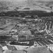
RAF WWII oblique aerial photograph of the south end of the Kincardine Bridge. Visible are two pillboxes protecting the approach to the bridge. |
10/10/1941 |
Item Level |
 |
On-line Digital Images |
SC 2493007 |
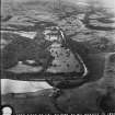
RAF WWII oblique air photograph of the aluminium rolling mill at Falkirk. |
15/6/1944 |
Item Level |
 |
On-line Digital Images |
SC 2498868 |
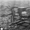
RAF WWII oblique aerial photograph of Langholm Barracks taken from the NW. Langholm town is visible in the background. |
26/6/1941 |
Item Level |
 |
On-line Digital Images |
SC 2498869 |
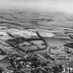
RAF WWII oblique aerial photograph of Langholm Barracks taken from the SE. Part of Langholm town is also visible in the left foreground. |
26/6/1941 |
Item Level |
 |
On-line Digital Images |
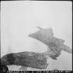
SC 2511697 |
RAF WWII oblique aerial photograph from SW of Cupar and the Radio Station at Hawk Law. |
24/6/1943 |
Item Level |
 |
On-line Digital Images |
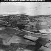
SC 2507211 |
RAF WWII oblique aerial photograph of Inchcolm. Visible is the Abbey and a coastal gun battery with the accommodation huts for crew. |
2/10/1941 |
Item Level |
 |
On-line Digital Images |
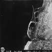
SC 2510551 |
RAF WWII oblique aerial photograph of part of Methil Town from the NW. Taken from above a point just S of Kennoway. Also visible is the harbour with part of a wartime convoy lying offshore. |
14/8/1943 |
Item Level |
 |
On-line Digital Images |
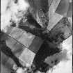
SC 2510552 |
RAF WWII vertical aerial photograph of Methil Town and Methil Docks and harbour. The area covered extends from Leven to the NE edge of Buckhaven and inland as far as West Kirkland. |
19/6/1941 |
Item Level |
 |
On-line Digital Images |
SC 2505663 |
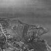
RAF WWII vertical aerial photograph of part of the Kaimes Hill. The prehistoric fort defences are visible immediately NE of the quarrying. |
9/9/1943 |
Item Level |
 |
On-line Digital Images |
SC 2493216 |
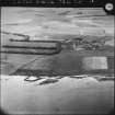
Aerial view of Bo'ness docks and part of Bo'ness town. |
21/5/1940 |
Item Level |
 |
On-line Digital Images |
SC 2513066 |
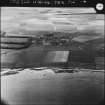
RAF WWII oblique aerial photograph of Kingsbarns village, harbour and Barns Law World War II Radio station, taken from the NE.
Print in record
|
17/6/1941 |
Item Level |
 |
On-line Digital Images |
SC 2513067 |
RAF WWII oblique aerial photograph of Kingsbarns village, harbour and Barns Law World War II Radio station, taken from the NE.
Print in record
|
17/6/1941 |
Item Level |


