 |
Digital Files (Non-image) |
WP 000115 |
Geophysical Survey Data: Area 4 Resistance Data (Greyscales). |
c. 2006 |
Item Level |
 |
Digital Files (Non-image) |
WP 000116 |
Geophysical Survey Data: Area 4 Magnetic Data (Greyscale). |
c. 2006 |
Item Level |
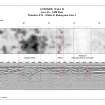 |
Digital Files (Non-image) |
WP 000117 |
Geophysical Survey Data: Area 4 GPR data 4A (Timeslice and Radargram). |
c. 2006 |
Item Level |
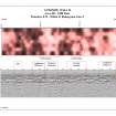 |
Digital Files (Non-image) |
WP 000118 |
Geophysical Survey Data: Area 4 GPR data 4B (Timeslice and Radargram). |
c. 2006 |
Item Level |
 |
Digital Files (Non-image) |
WP 000119 |
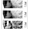
Geophysical Survey Data: Area 5 Resistance Data (Greyscales). |
c. 2006 |
Item Level |
 |
Digital Files (Non-image) |
WP 000121 |
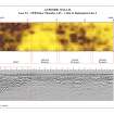
Geophysical Survey Data: Area 5 GPR Data 5A (Timeslice and Radargram). |
c. 2006 |
Item Level |
 |
Digital Files (Non-image) |
WP 000122 |
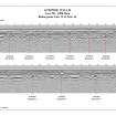
Geophysical Survey Data: Area 5 GPR Data 5B (Radargrams). |
c. 2006 |
Item Level |
 |
Digital Files (Non-image) |
WP 000123 |
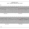
Geophysical Survey Data: Area 5 GPR Data 5C (Radargrams). |
2006 |
Item Level |
 |
Digital Files (Non-image) |
WP 000124 |
Geophysical Survey Data: Area 6 Resistance Data (Greyscales). |
c. 2006 |
Item Level |
|
Digital Files (Non-image) |
GV 004202 |
Geophysical Survey Data: Area 5 GPR interpretation (A3 landscape in paper space plot at 1:1). |
c. 2006 |
Item Level |
|
Digital Files (Non-image) |
GV 004203 |
Geophysical Survey Data: Area 6 Desk Based Assessment (A3 landscape in paper space plot at 1:1). |
c. 2006 |
Item Level |
|
Digital Files (Non-image) |
GV 004204 |
Geophysical Survey Data: Area 6 Location (A4 landscape in paper space plot at 1:1). |
c. 2006 |
Item Level |
|
Digital Files (Non-image) |
GV 004205 |
Geophysical Survey Data: Area 6 GPR Traverses (A3 landscape in paper space plot at 1:1). |
c. 2006 |
Item Level |
|
Digital Files (Non-image) |
GV 004206 |
Geophysical Survey Data: Area 6 Res and Mag Data Greyscales (A3 landscape in paper space plot at 1:1). |
c. 2006 |
Item Level |
|
Digital Files (Non-image) |
GV 004207 |
Geophysical Survey Data: Area 6 Res Interpretations (A3 landscape in paper space plot at 1:1). |
c. 2006 |
Item Level |
|
Digital Files (Non-image) |
GV 004208 |
Geophysical Survey Data: Area 6 Mag Interpretations (A3 landscape in paper space plot at 1:1). |
c. 2006 |
Item Level |
|
Digital Files (Non-image) |
GV 004229 |
Geophysical Survey Data: Area 1: Greyscale plots and interpretations of resistance and gradiometer data; outline of GPR survey area with individual traverse locations; radargram and interpretation of GPR data in 2D (points 250533.17,672269.20 and 250533.41, 672229.20 are in correct georeferenced positions). |
c. 2006 |
Item Level |
|
Digital Files (Non-image) |
GV 004230 |
Geophysical Survey Data: Area 1 - GPR Survey: Radargram and interpretation of GPR data in 3D: top (surface) edge - points 250533.17, 672269.20 and 250533.41, 672229.20 are in correct georeferenced positions. |
c. 2006 |
Item Level |
|
Digital Files (Non-image) |
GV 004231 |
Geophysical Survey Data: Area 2: Greyscale plots and interpretations of resistance and gradiometer data; outline of GPR survey area with individual traverse locations; timeslice and interpretation of GPR data; radargram and interpretation of GPR data in 2D (points 259516.36, 672114.90 and 259528.72, 672076.86 are in correct georeferenced positions). |
c. 2006 |
Item Level |
|
Digital Files (Non-image) |
GV 004232 |
Geophysical Survey Data: Area 2 - GPR Survey: Radargram and interpretation of GPR data in 3D: top (surface) edge - points 259516.36, 672114.90 and 259528.72, 672076.86 are in correct georeferenced positions. |
c. 2006 |
Item Level |
|
Digital Files (Non-image) |
GV 004241 |
Geophysical Survey Data: Balmuildy Bridge to Bearsden; Location Diagram (A3 portrait in paper space plot at 1:1). Part of Section 1 of the full report (WP 000216). |
c. 2006 |
Item Level |
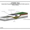 |
Digital Files (Non-image) |
WP 000222 |
Geophysical Survey Data: Balmuildy Bridge to Bearsden; Schematic Section through Ditch and Rampart (A4 landscape). Part of Section 3 of the full report (WP 000216). |
c. 2006 |
Item Level |
|
Digital Files (Non-image) |
GV 004293 |
Geophysical Survey Data: Balmuildy Bridge to Bearsden; Greyscale plots and interpretations of resistance and gradiometer data. |
c. 2006 |
Item Level |
|
Digital Files (Non-image) |
GV 004294 |
Geophysical Survey Data: Balmuildy Bridge to Bearsden; positions of GPR, Electrical Imaging (EI) and Seismic traverses. |
c. 2006 |
Item Level |


