Pricing Change
New pricing for orders of material from this site will come into place shortly. Charges for supply of digital images, digitisation on demand, prints and licensing will be altered.
Upcoming Maintenance
Please be advised that this website will undergo scheduled maintenance on the following dates:
Thursday, 9 January: 11:00 AM - 3:00 PM
Thursday, 23 January: 11:00 AM - 3:00 PM
Thursday, 30 January: 11:00 AM - 3:00 PM
During these times, some functionality such as image purchasing may be temporarily unavailable. We apologise for any inconvenience this may cause.
Tealing Airfield
Airfield (20th Century), Prisoner Of War Camp (20th Century)
Site Name Tealing Airfield
Classification Airfield (20th Century), Prisoner Of War Camp (20th Century)
Alternative Name(s) Muir Of Pert
Canmore ID 94183
Site Number NO43NW 51
NGR NO 40420 37170
NGR Description Centred on NO 40420 37170
Datum OSGB36 - NGR
Permalink http://canmore.org.uk/site/94183
- Council Angus
- Parish Tealing
- Former Region Tayside
- Former District City Of Dundee
- Former County Angus
NO43NW 51.00 Centred 40420 37170
NO43NW 51.01 NO 40654 36971 Control tower
NO43NW 51.02 Centred NO 40744 36805 Aircraft Hangars; Buildings; Huts
NO43NW 51.03 Centred NO 4188 3702 Military Camps
NO43NW 51.04 NO 39815 37191 Firing Range
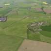
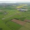
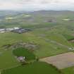
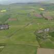
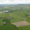
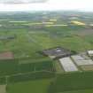
This airfield lies in a hollow overlooked by a range of hills to the W. Opened in 1942, it was placed on Care and Maintenance in June 1945. One of the runways is broken up, while poultry sheds cover the other. The control tower remains but the hangars have gone.
D J Smith 1983
The airfield is on the W side of the A90 to the N of Dundee. The runways and many buildings are still extant. The accommodation site was also use as a prisoner-of-war camp in the latter part of the war.
J Guy 2000; NMRS MS 810/9
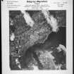
Tealing Airfield and associated accommodation camps is visible on a series of vertical air photographs taken in 1947 (CPE/Scot/UK 267, 3002-3007, flown 14 August 1947). The photographs show the airfield had two runways, running N-S with the main running E-W. The control tower (NO43NW 51.01) is visible on the photographs and stands about 100m NW of the technical area within the perimeter track.
The main technical area (NO43NW 51.02) is on the SE area, outside the perimeter tracks. Within this area there were three aircraft hangars all of which have since been removed and many huts and buildings, some of which survive among the modern structures now located in this area. There are also several dispersal areas, mainly on the NE, N and W sides of the airfield, all of which had several blister hangars over concrete aprons.
The accommodation areas (NO43NW 51.03) are widely dispersed, from immediately W of the present village of Inveraldie, N to Balmuir Cottages, with two further smalle groups of huts visible on the photographs at Shielhill farmsteading and in a field about 300m to the S.
Most of the accommodation buildings and huts have been removed, the new village of Inveraldie and the present main A929(T) road having taken the ground once occupied by these structures (visible on vertical air photographs All Scotland Survey, [Jasair], 51788 191-193, 216-217, flown 18, 24 June 1988).
No evidence can be seen on the photographs for the location of the Prisoner-of-war camp, whether in the former technical area or the main part of the domestic site further to the E.
Information from RCAHMS (DE), October 2005


