
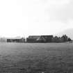
Westhaugh Of Tulliemet Farm


Farmhouse (Period Unassigned)
Site Name Westhaugh Of Tulliemet Farm
Classification Farmhouse (Period Unassigned)
Alternative Name(s) Haugh Of Tulliemet; West Haugh Of Tullieme; Thaugh Of Tulliemet
Canmore ID 87620
Site Number NN95SE 39
NGR NN 98646 51232
Datum OSGB36 - NGR
Permalink http://canmore.org.uk/site/87620

- Council Perth And Kinross
- Parish Logierait
- Former Region Tayside
- Former District Perth And Kinross
- Former County Perthshire
NN95SE 39 98646 51232
(Location cited as NN 991 507). Horse-gin house, Haugh of Tulliemet, early 19th century. A circular rubble building with a steeply pitched slated roof.
J R Hume 1977.
NN95SE 39.00 Westhaugh of tulliemet farmhouse
NN95SE 39.01 Farmsteading and horsemill
Archaeological Evaluation (2 October 2020)
NN 98653 51135 Trial trenching was conducted by Alder Archaeology on 2 October 2020 prior to the construction of a new agricultural shed and yard. The work took place on 2 October 2020. The site lay alongside the A9 road near Ballinluig between two Scheduled Monuments: a prehistoric standing stone (Canmore ID: 26346) and an early medieval cross slab (Canmore ID: 26347). Four trenches were excavated, exposing in one the base of what may have been a drainage ditch. No significant archaeology resulted.
Archive: NRHE (intended)
Funder: Private individual
C Fyles − Alder Archaeology Ltd
(Source: DES Volume 21)
OASIS ID: alderarc1-404882

