
Following the launch of trove.scot in February 2025 we are now planning the retiral of some of our webservices. Canmore will be switched off on 24th June 2025. Information about the closure can be found on the HES website: Retiral of HES web services | Historic Environment Scotland
Torduff


Tower House (Medieval)
Site Name Torduff
Classification Tower House (Medieval)
Alternative Name(s) 'Torduf'
Canmore ID 86802
Site Number NY26SE 6
NGR NY 258 646
NGR Description NY c. 258 646
Datum OSGB36 - NGR
Permalink http://canmore.org.uk/site/86802

- Council Dumfries And Galloway
- Parish Gretna
- Former Region Dumfries And Galloway
- Former District Annandale And Eskdale
- Former County Dumfries-shire
Note (4 January 1996)
NY 258 646 NY26SE 6
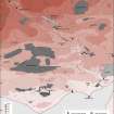
The tower of 'Torduf' is depicted on a map of 1590 and in Blaeu's Atlas. It may have stood near Torduff steading (NY26SE 8).
Information from RCAHMS (IF), 4 January 1996.
(J and R Hyslop 1912; J M Corrie 1916; J Stone 1991).
Listed as tower.
RCAHMS 1997.

