Scheduled Maintenance
Please be advised that this website will undergo scheduled maintenance on the following dates: •
Tuesday 3rd December 11:00-15:00
During these times, some services may be temporarily unavailable. We apologise for any inconvenience this may cause.
Ronas Hill
Chambered Cairn (Neolithic)
Site Name Ronas Hill
Classification Chambered Cairn (Neolithic)
Canmore ID 863
Site Number HU38SW 1
NGR HU 30556 83431
Datum OSGB36 - NGR
Permalink http://canmore.org.uk/site/863
- Council Shetland Islands
- Parish Northmavine
- Former Region Shetland Islands Area
- Former District Shetland
- Former County Shetland
HU38SW 1 3056 8342
(HU 3056 8343) Watch Tower (OE)
OS 6" map, Shetland, 2nd ed., (1900).
A possibly heel-shaped chambered cairn composed of large stones. It has been disturbed and the edge is now in- definite and overgrown with grass. The diameter was at least 45' and it rises to a height of 10'6", but appearances suggest that much of the material on the top has been heaped up at a comparatively recent date.
RCAHMS 1946, visited 1931; A S Henshall 1963.
Chambered cairn as described and planned by RCAHM.
Surveyed at 1/10,000 scale
Visited by OS (RL) 21st May 1969.
Field Visit (5 August 1931)
Chambered Cairn, Ronas Hill.
This is perhaps the most complete, though not the most interesting, chambered cairn that now survives in Shetland (Fig. 612). It stands on the very summit of Ronas Hill, which is the highest point in the whole archipelago, the cairn being thus no less than 1475 ft. above sea-level. Like most other ancient monuments in Shetland, it has been considerably scattered, so that any opinion as to its precise outline must be more or less conjectural. Originally, however, it was probably at least 45 ft. in diameter. It still rises to a height of 10 ft. 6 in., but appearances suggest that much of the material on the top has been heaped up at a comparatively recent date. The lower levels are grass-grown.
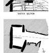
The body of the cairn has been formed of large stones. As will be seen from the plan, the single compartment chamber, which is constructed of massive blocks and is nearly 4 ft. high, somewhat resembles a cist, not merely in outline but in size, being only some 5 ft. 6 in. long by 3 ft. broad. It lies with its major axis almost due N. and S. The entrance (Fig. 610) is on the E., and the passage, a few of the cover stones of which are still in situ, varies in width from 2 ft. to 3 ft. 3 in., with a height of some 5 ft. 3 in. above the exterior ground-level. There is no record of any associated relics.
RCAHMS 1946, visited 5 August 1931
OS 6" map, Shetland, 2nd ed., (1900).
Publication Account (1997)
This is a very long and arduous walk, and Ronas Hill is often wreathed in mist, but on a clear sunny day the view from the cairn is well worth the effort, as is the cairn itself. Set on the highest point in Shetland (450m OD), its very remoteness has ensured that this cairn has survived the centuries relatively unscathed. Its chamber is still roofed, although much of the covering cairn is now scattered. This was probably a heel-shaped cairn, and the passage, some 2.4m long, opens into a rectangular chamber, 1.7m by 0.9m. The sides and back of the chamber are built with very large slabs, and a single slab forms the roof at a height of just over a metre. Nothing is known of the original contents.
Information from ‘Exploring Scotland’s Heritage: Shetland’, (1997).


