Scheduled Maintenance
Please be advised that this website will undergo scheduled maintenance on the following dates: •
Tuesday 3rd December 11:00-15:00
During these times, some services may be temporarily unavailable. We apologise for any inconvenience this may cause.
Dunbeath, Mill
Dam (Period Unassigned), Watermill (Period Unassigned)
Site Name Dunbeath, Mill
Classification Dam (Period Unassigned), Watermill (Period Unassigned)
Alternative Name(s) Lat 285; Corn Mill, Dunbeath; Dunbeath Water
Canmore ID 8026
Site Number ND12NE 10
NGR ND 15995 29899
Datum OSGB36 - NGR
Permalink http://canmore.org.uk/site/8026
- Council Highland
- Parish Latheron
- Former Region Highland
- Former District Caithness
- Former County Caithness
ND12NE 10 15995 29899
Mill (dis) [NAT]
Lade (dis) [NAT] (to NW)
OS (GIS) MasterMap, July 2010.
Location formerly entered as ND 1599 2989.
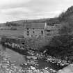
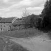
(Location cited as ND 160 299). Corn mill, Dunbeath, probably early 19th century. A partly ruinous2- and 3-storey rubble building, now gutted. Had an internal overshot wheel.
J R Hume 1977.
Mill and dam observed by Batey, but removed from survey list because not ruinous. However, a sluice and mill lead are shown on the first edition of the OS 6-inch map (Sutherland, sheet xxxix).
C E Batey, Caithness Coastal Survey 1982 (LAT 285).


