
Following the launch of trove.scot in February 2025 we are now planning the retiral of some of our webservices. Canmore will be switched off on 24th June 2025. Information about the closure can be found on the HES website: Retiral of HES web services | Historic Environment Scotland
Pinglehole Tower


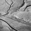
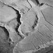
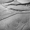
Enclosure(S) (Period Unassigned), Field Boundary(S) (Period Unassigned), Ring Enclosure(S) (Period Unassigned), Sheepfold (Period Unassigned), Tower House (Medieval)(Possible)
Site Name Pinglehole Tower
Classification Enclosure(S) (Period Unassigned), Field Boundary(S) (Period Unassigned), Ring Enclosure(S) (Period Unassigned), Sheepfold (Period Unassigned), Tower House (Medieval)(Possible)
Alternative Name(s) Pingillholls
Canmore ID 67982
Site Number NY59NE 8
NGR NY 5570 9626
Datum OSGB36 - NGR
Permalink http://canmore.org.uk/site/67982


- Council Scottish Borders, The
- Parish Castleton
- Former Region Borders
- Former District Roxburgh
- Former County Roxburghshire
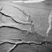
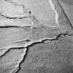
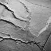
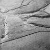
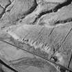
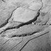
NY59NE 8 c.5570 9626.
(Area centred NY 55709626) 'Pingillholls' with tower symbol on Ponts map of Liddesdale (1608).

