
Seven Brethren


Stone Circle (Neolithic) - (Bronze Age)
Site Name Seven Brethren
Classification Stone Circle (Neolithic) - (Bronze Age)
Alternative Name(s) Paddockhole Bridge; Whiteholm Rigg; Whiteholme Rig
Canmore ID 67223
Site Number NY28SW 3
NGR NY 21724 82676
Datum OSGB36 - NGR
Permalink http://canmore.org.uk/site/67223


- Council Dumfries And Galloway
- Parish Tundergarth
- Former Region Dumfries And Galloway
- Former District Annandale And Eskdale
- Former County Dumfries-shire
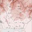
Remains of at least seven visible upright stones set in a roughly circular arrangement within improved pasture on gentle north-facing slope within Water of Milk river valley. Main views along and across valley in north-east to north-west arc. Views in other directions restricted by topography. Consented Ewe Hill development visible to north-east and existing Minsca Wind Farm to the south.
Information from Héléna Gray, (CFA Archaeology Ltd), August 2015
NY28SW 3 2171 8269.
(NY 2171 8269) Seven Brethren (NAT)
Stone Circle (NR) (Remains of)
OS 6" map (1957)
Seven of a probable 12 original stones set in a circle 60 ft. in diameter remain. Four are still (1963) in situ, none protruding more than 2 ft above ground. Known as the 'Seven Brethren'.
RCAHMS 1920; R W Feachem 1963.
The remains of this stone circle are generally as described. An eighth stone not in situ lies to the north. Name confirmed.
Revised at 25".
Visited by OS (RD) 16 July 1970.
(Whiteholm Rigg). Possibly of flattened circle form (measuring 20.1 by 18.9m) with outlying stone(s).
A Burl 1976.
Scheduled as Seven Brethren, stone circle, Whiteholme Rig.
Information from Historic Scotland, scheduling document dated 8 September 2003.
Note (1997)
NY 2171 8269 NY28SW 3
Listed as stone circle.
RCAHMS 1997
Project (29 May 2014)
An archaeological evaluation was undertaken by CFA Archaeology Ltd, a desk based assessment and walk over survey (May 29th 2014) was conducted
The historic environment record within the Site Boundary is relatively limited, although there is some potential for the proposed development site to contain previously unknown heritage assets from at least the later prehistoric period onwards, given the historic landscape character of the wider area. Taking this into account, the archaeological potential of the proposed development site is considered to be low.
A summary assessment, on a site by site basis, of the predicted effects on the settings of assets within a 10km radius where the blade tip ZTV indicates that there would be theoretical views of one or more turbines
information from Héléna Gray, (CFA Archaeology Ltd), August 2015
OASIS ID: cfaarcha1-278420

