
Following the launch of trove.scot in February 2025 we are now planning the retiral of some of our webservices. Canmore will be switched off on 24th June 2025. Information about the closure can be found on the HES website: Retiral of HES web services | Historic Environment Scotland
Kirkpatrick Tower


Tower House (Medieval)
Site Name Kirkpatrick Tower
Classification Tower House (Medieval)
Alternative Name(s) Kirkpatrick House
Canmore ID 67136
Site Number NY27SE 8
NGR NY 2751 7017
Datum OSGB36 - NGR
Permalink http://canmore.org.uk/site/67136


- Council Dumfries And Galloway
- Parish Kirkpatrick-fleming
- Former Region Dumfries And Galloway
- Former District Annandale And Eskdale
- Former County Dumfries-shire
NY27SE 8 2751 7017.
(Name: NY 2758 7014) Tower (NR) (Site of)
OS 6" map (1957)
For Kirkpatrick House and sculptured stones, see NY27SE 23 and NY27SE 31.00 respectively.
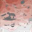
Kirkpatrick Farm is the site of Kirkpatrick Tower seen in a map of c. 1590.
BM Royal MS. 18Diii, Burghley Atlas 1590
A stone, dated 1543 or 1548, recovered by Mr James Rae, owner of the farm, when rebuilding a steading in 1958, and a second stone, dated 1674, are built into outbuildings. Part of a cross-slab walled into the W gable of the bothy and a floor-slab with floriated cross set in the front garden wall no doubt came from the parish church.
In 1960 C A R Radford and either R C Reid or W F Cormack inspected the buildings. There were no signs of an early tower, but in the recently reconsturcted barn, remains of a 17th century house were discovered.
R C Reid and W F Cormack 1961
NY 2751 7017. No trace of this tower remains. The date-stones, etc. are in the positions stated by Reid and Cormack.
Visited by OS (WDJ) 18 October 1967.
Note (1997)
NY 2751 7017 NY27SE 8
Listed as tower.
RCAHMS 1997.

