Holm Of Daltallochan
Stone Circle (Neolithic) - (Bronze Age)(Possible)
Site Name Holm Of Daltallochan
Classification Stone Circle (Neolithic) - (Bronze Age)(Possible)
Canmore ID 63878
Site Number NX59SE 4
NGR NX 5528 9422
Datum OSGB36 - NGR
Permalink http://canmore.org.uk/site/63878
- Council Dumfries And Galloway
- Parish Carsphairn
- Former Region Dumfries And Galloway
- Former District Stewartry
- Former County Kirkcudbrightshire
NX59SE 4 5528 9422.
(NX 5528 9422) Stone Circle (NR).
OS 6" map (1957)
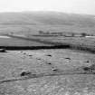
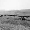
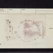
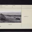
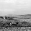
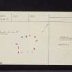
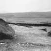
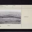
This stone circle, in a low-lying meadow, and around a slight elevation, consists of 13 irregularly-shaped masses of whinstone rock and boulders, varying in size as exposed, from 2ft to 7ft 3 ins in length. They are nearly all displaced (except one large mass which stands just E of N) and lie prostrate, several being considerably overgrown with turf. The setting is an irregular oval, 81ft NNE-SSW by 59ft. It narrows towards the SSW, where the outline is slightly concave, as if some of the stones had been moved from their original positions.
RCAHMS 1914, visited 1911; F R Coles 1895
Though Coles' stylised plan broadly fits Burl's compound ring category, it is listed only as a possible stone circle and described as unconvincing.
A Burl 1976
This setting of 13 stones cannot be classified with any certainty. The stones, as stated, vary greatly in size and shape and though all appear artificially placed they rest without any apparent regard for grading, orientation or visual effect. No socket depressions are evident. Coles' plan bears little relation to the present setting which forms a crude oval measuring 24.0m N-S by 20.0m E-W.
Surveyed at 1:10 000.
Visited by OS (JRL) 27 February 1978


