
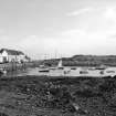
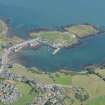
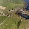
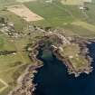
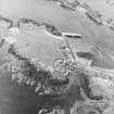
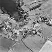
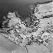
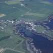
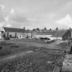
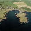
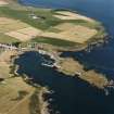
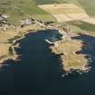
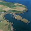
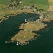
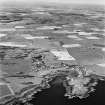
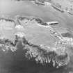
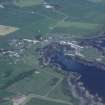
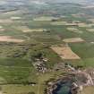
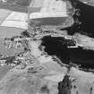
Isle Of Whithorn, Harbour


Harbour (16th Century)
Site Name Isle Of Whithorn, Harbour
Classification Harbour (16th Century)
Alternative Name(s) Whithorn Harbour; Solway Firth
Canmore ID 63082
Site Number NX43NE 27
NGR NX 47787 36242
Datum OSGB36 - NGR
Permalink http://canmore.org.uk/site/63082


- Council Dumfries And Galloway
- Parish Whithorn
- Former Region Dumfries And Galloway
- Former District Wigtown
- Former County Wigtownshire
NX43NE 27.00 47787 36242
NX43NE 27.01 NX 47772 36354 Pier
See also NX44SE 32.
For fish-trap at NX 476 364, see NX43NE 23.
For associated warehouses at NX 4788 3635 and NX 4786 3629, see NX43NE 33 and NX43NE 34 respectively.
For boatbuilding yard and slipway at NX 4786 3637 and NX 47857 36355, see NX43NE 42.00 and NX43NE 42.01 respectively.
For extended discussion of pilgrimage-routes to Whithorn in maritime context, see Graham 1979, 69-73.
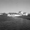
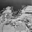
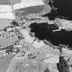
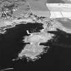
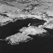
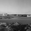
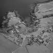
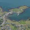
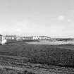
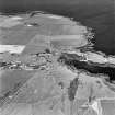
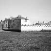
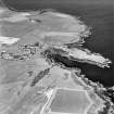
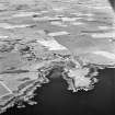
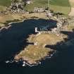
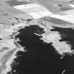
(Location cited as NX 478 363). Harbour, Isle of Whithorn, formed in the 16th century but substantially rebuilt in 1790 and later. An L-plan pier of rubble construction with one- and two-storey stores. At the landward end of the pier is a slipway with a wooden single-storey building, formerly a boatbuilding yard [NX43NE 43.00].
J R Hume 1976.

