
Glenwhilly


Bank (Earthwork) (Prehistoric), Clearance Cairn(S) (Prehistoric), Hut Circle (Prehistoric)
Site Name Glenwhilly
Classification Bank (Earthwork) (Prehistoric), Clearance Cairn(S) (Prehistoric), Hut Circle (Prehistoric)
Canmore ID 61820
Site Number NX17SE 35
NGR NX 16497 72378
NGR Description Centre
Datum OSGB36 - NGR
Permalink http://canmore.org.uk/site/61820


- Council Dumfries And Galloway
- Parish New Luce
- Former Region Dumfries And Galloway
- Former District Wigtown
- Former County Wigtownshire
NX17SE 35 1649 7238.
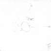
What may be a robbed cairn is overlain by the S end of the Glenwhilly sheep rees; it measures about 11m in diameter but has been reduced to an uneven stony platform 0.4m in maximum height. To the S there are traces of a low stony bank and two small cairns.
RCAHMS 1987, visited (SH) 4 July 1986
Measured Survey (8 August 1985)
RCAHMS surveyed the hut circle, enclosure at small cairns at Drumanee, Glenwhilly on 8 August 1985 with plane-table and self-reducing alidade at a scale of 1:1000.
Field Visit (23 March 2022)
What was previously classified and depicted as a robbed cairn has been reviewed in the field and revised as a hut circle of prehistoric date with a possible entrance in the SE. The stony bank and two small clearance cairns also mentioned in the earlier account were visible on the date of visit.
Visited by HES Archaeological Survey (A. Gannon), 23 March 2022.
Field Visit (23 March 2022)
The location, classification and period of this site have been reviewed and changed from CAIRN (PERIOD UNASSIGNED).

