Pricing Change
New pricing for orders of material from this site will come into place shortly. Charges for supply of digital images, digitisation on demand, prints and licensing will be altered.
Round Dounan
Motte (Medieval)
Site Name Round Dounan
Classification Motte (Medieval)
Alternative Name(s) Dunragit House
Canmore ID 61250
Site Number NX15NW 4
NGR NX 14834 57953
NGR Description Centre
Datum OSGB36 - NGR
Permalink http://canmore.org.uk/site/61250
- Council Dumfries And Galloway
- Parish Old Luce
- Former Region Dumfries And Galloway
- Former District Wigtown
- Former County Wigtownshire
NX15NW 4 1483 5795.
(NX 1483 5795) Round Dounan (NR)
OS 6" map (1957)
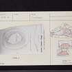
Fort at Dunragit, on a natural hillock of outcropping rock some 12-14 feet in height. Reid's survey of 1951 showed an outer rampart from which stones protruded. A terrace, some 18 feet wide, noticed by the Commissioners, on the W side, he showed to have been formed by a later track entering the defences.
The fort itself was a stone built structure with an entrance through a straight passage at the inner end of which must have been a second gate. A thickening of the wall to the W. of the outer gate indicated theh position of a gate tower.
The fort was dated to the 5th-6th centuries by Radford and Reid deduces that this is the Fort of Rheged, the kingdom which flourished in the 4th and 5th centuries, erroneously sited by Watson at the 12th century Mote of Drochdool (NX15NW 6) (believing that to be the Mote of Dunragit). Round Dounan is not an early name.
RCAHMS 1912; R C Reid 1952; W J Watson 1926
This small fort is generally as described and planned by the above authorities. Reid's "outer rampart" encircles the base of the knoll except on the east side where the natural slopes are an adequate defence. No trace of any structure was seen in the interior of the fort. The name Round Dounan is not in local use.
Resurveyed at 1/2500.
Visited by OS (RD) 13 March 1968
What may be a motte fashioned from a natural mound (up to 5.3m high) is situated in woods 230m SSW of Dunragit House. Its irregularly shaped summit measures 28m by 25m. A terrace (up to 5m broad) flanks the base of the mound on the W.
RCAHMS 1987, visited October 1986.
Note (20 December 2013 - 18 May 2016)
What may be a fortified enclosure occupies the Round Dounan, a low hillock within the policies of Dunragit House. Oval on plan the summit of the hillock measures about 28m from NW to SE by 25m transversely, and according to R C Reid (1952) it is enclosed by a stone wall, though no trace of this feature has been noted since; Reid also identified an outer rampart extending round the foot of the hillock, where the principal feature visible is a terrace some 5m broad on the W. To some extent the identification of this enclosure as a fort rests on the derivation of the name Dunragit from 'Fort of Rheged', an attribution that has been employed to suggest a date for the occupation of the Round Dounan in the 5th-6th centuries AD (most recently discussed by McCarthy 2002). Typologically, however, the appearance of the earthworks have more in common with the form of a medieval motte fashioned from a natural knoll.
Information from An Atlas of Hillforts of Great Britain and Ireland – 18 May 2016. Atlas of Hillforts SC0204
Contour Survey (11 February 2014 - 12 February 2014)
NX 14834 57958 A topographical survey of the surviving remains of a late prehistoric or early historic fort at Round Dounan was carried out 11–12 February 2014. The survey results were used to create a digital terrain model, contour based plans and oblique terrain models of the site within its landscape setting, which will be used to inform future conservation and management of the monument by Forestry Commission Scotland.
Archive: RCAHMS. Report: ADS and RCAHMS (intended)
Funder: Forestry Commission Scotland
Louise Baker and Enda O'Flaherty - Rubicon Heritage Services Ltd
(Source: DES)
OASIS ID: rubiconh1-187969
Note (17 January 2022)
The location, classification and period of this site have been reviewed.


