Balgreggan
Motte (Medieval)
Site Name Balgreggan
Classification Motte (Medieval)
Alternative Name(s) Sandhead, Balgreggan Mote
Canmore ID 60606
Site Number NX05SE 6
NGR NX 09635 50494
NGR Description Centre
Datum OSGB36 - NGR
Permalink http://canmore.org.uk/site/60606
- Council Dumfries And Galloway
- Parish Stoneykirk
- Former Region Dumfries And Galloway
- Former District Wigtown
- Former County Wigtownshire
NX05SE 6 0964 5048.
(NX 0964 5048) Balgreggan Mote (NR)
OS 6" map (1957) and 1:10000 map (1977)
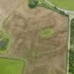
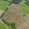
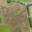
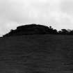
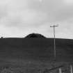
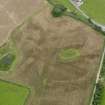
The motte occupies the crest of a ridge and is surrounded by a 12 ft wide ditch, now shallow and almost obliterated on the west side, which appears to be drawn out towards a point on the NE.
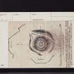
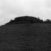
The mound is 25 ft. high on the N and W and about 40 ft. high on the S. The summit, wrecked by the construction of an observation post during the second World War, measured about 60 ft. by 52 ft. with an 8-10 ft. wide bank around the edge, within which was a 5 ft. wide ditch which separated it from a 7 ft. 6 ins. wide concentric bank enclosing a 12 ft. diameter central area. This inner enclosure was destroyed by the digging of a large pit during the construction of the post.
RCAHMS 1912, visited 1911; RCAHMS TS. 1953
Balgreggan Mote is generally as described except that the ditch survives only on the east, where there is a slight outer bank above the steep natural slopes. The summit is now featureless save for a circular concrete slab, the remains of the observation post, at the centre. Revised at 25".
Visited by OS (RD) 3 September 1970
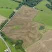
Prominently situated on the edge of the degraded cliffline 200m N of Sandhead, this motte stands to a height of up to 8.7m and its oval summit (damaged by the construction of an observation post during the Second World War) measures 20m by 17m. At the base of the motte on the S there is a ditch (up to 5m broad and 0.9m deep) and on the E a terrace; fragments of burnt wood and daub have been exposed by weathering of the W side of the summit; two sherds of pottery have also been found.
Name Book; RCAHMS 1912; 1985, visited August 1984.
Field Visit (9 July 1953)
Motte, Balgreggan (Inventory No. 434).
The top of this motte has been wrecked by the construction of an observation-post on it during the second World War. Part of the material for the post has been obtained by digging a large pit in the centre of the motte, thereby destroying the inner enclosure shown on the Inventory plan. The work is unquestionably a motte.
Visited by RCAHMS (KAS) 9 July 1953.
Note (23 November 2021)
The location, classification and period of this site have been reviewed.


