
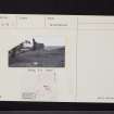
Hirendean Castle


Tower House (Medieval)
Site Name Hirendean Castle
Classification Tower House (Medieval)
Canmore ID 51658
Site Number NT25SE 2
NGR NT 2984 5121
Datum OSGB36 - NGR
Permalink http://canmore.org.uk/site/51658


- Council Midlothian
- Parish Temple
- Former Region Lothian
- Former District Midlothian
- Former County Midlothian
NT25SE 2 2983 5121.
(NT 2983 5121) Hirendean Castle (NR) (Ruins of).
OS 6" map (1909)
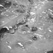
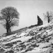
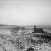
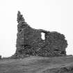
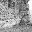
The building appears to date from the 16th century. The structure is built of irregular coursed rubble, and measures externally 25ft north-south by 44 1/2 ft east-west, with walls 3 1/2 ft thick. Only the south wall and a fragment of the west gable remain, showing that the building had at least three storeys.
The condition of the ruin is very bad and the upper portion of the south-west angle, where the wall is still standing for a height of some 30 feet, threatens to fall.
(RCAHMS 1929)
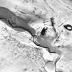
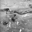
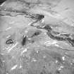
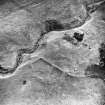
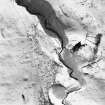
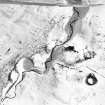
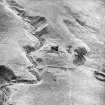
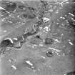
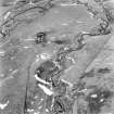
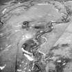
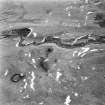
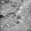
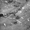
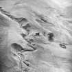
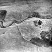
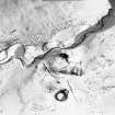
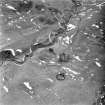
Hirendean Castle, the remains of a peel-tower, originally measured 12m x 7m overall but otherwise is as described by the Commission. The S wall and part of the W gable are still standing; the remainder is a pile of rubble in which part of the N wall can be traced. Around the building are the probable remains of a later farm comprising building foundations and enclosures.
Visited by OS (JP) 16 February 1970
Field Visit (15 July 1915)
Hirendean Castle.
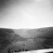
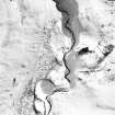
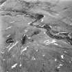
The ruin of this castle is situated at an elevation of over 1000 feet above sea-level on the flat northern shoulder of Hirendean Hill. The ground falls steeply to north and west; on the east is the deeply worn course of the Hirendean Burn, and to the south rises the hill.
The structure is built of irregularly coursed rubble and is oblong on plan, measuring externally from north to south 25 feet and from east to west 44 ½ feet, with walls 3 ½ feet thick. Only the south wall and a fragment of the west gable remain; these show that the building had at least three storeys, the lowest of which was ceiled with a stone barrel-vault. The masonry is inferior, and the long and short quoins are undressed; the free stone jambs of the windows and of the entrance at the west end of the south wall, though dressed, are unmoulded. One jamb of the entrance is in situ and is checked for three doors, of which the outermost opened outwards.
The condition of the ruin is very bad; the upper portion of the south-west angle, where the wall is still standing for a height of some 30 feet, threatens to fall. The building appears to date from the 16th century.
There are traces of outbuilding immediately to the south and of enclosures to the west and north.
HISTORICAL NOTE. The lands of "Herringden" belonged to the Abbey of Newbattle (1). In this way they came with the rest to the Earl of Lothian, Lord Newbattle. A charter of confirmation to Robert, Earl of Lothian, in 1620, includes 'Herendene cum fortalicio'. In 1649 Patrick Scot was returned heir to his father, William Scot, in the lands and the 'steiding de Herring-deane' in the barony of Newbattle (2).
RCAHMS 1933, visited 15 July 1915.
(1) Reg. de Neubotle, p. 328; (2) Inquisit. Spec., Edinb., No. 1009.

