
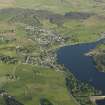
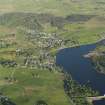
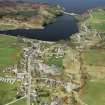
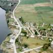
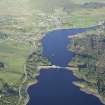
Loch Shin


Crannog (Period Unassigned)
Site Name Loch Shin
Classification Crannog (Period Unassigned)
Alternative Name(s) Eilean Ma Ruibhe
Canmore ID 4983
Site Number NC50NE 15
NGR NC 5769 0685
Datum OSGB36 - NGR
Permalink http://canmore.org.uk/site/4983


- Council Highland
- Parish Lairg
- Former Region Highland
- Former District Sutherland
- Former County Sutherland
NC50NE 15 5769 0685.
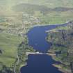
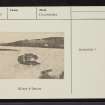
(NC 5769 0685) St Maelrubha (d 722) may have had a cell on the island on Loch Shin which is named after him, Eilean Ma Ruibhe, and lies about 60 yards from the shore of the south end immediately below the manse of Lairg (? Eilean a Chairn: NC 5769 0685).
J Mackay 1897; F O Blundell 1913; W J Watson 1926.
Rev F MacLeod, Lairg could offer no further information on this site.
Visited by OS (W D J) 25 June 1963
The tradition of an association of St Maelrubha with Eilean a Chairn, though tenuous, is still known to the hydro-electric engineer at Loch Shin Dam. There is no trace of any structures, but the island appears wholly artificial, being composed entirely of rubble stones, now covered with turf and stunted trees. It measures 9.0m in diameter and 0.6m high, but the stones extend a further two or three metres around the island before deep water. The engineer states that the water level of Little Loch Shin has been raised about a foot as a result of the dam at NC 582 051.
Visited by OS (N K B) 9 August 1976.
Surveyed at 1/2500.
Visited by OS (J B) 16 March 1979.

