Pricing Change
New pricing for orders of material from this site will come into place shortly. Charges for supply of digital images, digitisation on demand, prints and licensing will be altered.
Upcoming Maintenance
Please be advised that this website will undergo scheduled maintenance on the following dates:
Thursday, 9 January: 11:00 AM - 3:00 PM
Thursday, 23 January: 11:00 AM - 3:00 PM
Thursday, 30 January: 11:00 AM - 3:00 PM
During these times, some functionality such as image purchasing may be temporarily unavailable. We apologise for any inconvenience this may cause.
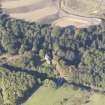
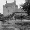
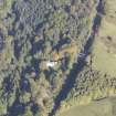
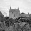
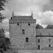
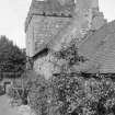
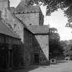
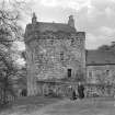
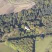
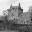
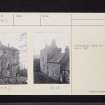
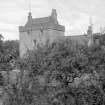
Castlecary Castle
Tower House (15th Century)
Site Name Castlecary Castle
Classification Tower House (15th Century)
Alternative Name(s) Castle Cary
Canmore ID 45827
Site Number NS77NE 23
NGR NS 78663 77526
Datum OSGB36 - NGR
Permalink http://canmore.org.uk/site/45827
- Council Falkirk
- Parish Falkirk
- Former Region Central
- Former District Falkirk
- Former County Stirlingshire
NS77NE 23 78663 77526
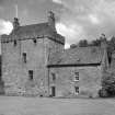
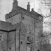
The tower and eastern range have been restored, and are in use as a dwelling house. Only the lower portion of the western courtyard wall appears to be an original feature.
Visited by OS August 1959 and April 1967.
NS 7867 7752. Work by Falkirk Museum prior to the installation of a new sewage system revealed a broad ditch, 7.5m wide, under the 17th-century extension to the tower house. The ditch had been deliberately filled in for the construction of this wing, and may have been contemporary with the original structure of 1485.
Sponsor: R Hunter.
G B Bailey 1996
REFERENCE:
NMRS
I G Lindsay Collection, W/174
W/195
Photographic Survey (February 1958)
Photographic survey by the Scottish National Buildings Record/Ministry of Work in February 1958.
Note (1978)
Castle Cary NS 786 775 NS77NE 23
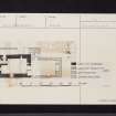
15th century tower-house with 17th century additions, possibly planned as an L-shaped building but not completed; it incorporates much reused Roman masonry.
RCAHMS 1978
(RCAHMS 1963, pp.243-6, no. 203)
Archaeological Evaluation (17 May 2007 - 20 December 2007)
NS 7870 7775 Topographic and earthwork surveys and an evaluation of the Castle Glen industrial area were undertaken from 17 May–20 December 2007, as part of the programme of works for the M80 Stepps to Haggs improvement scheme. The Castle Glen area is part of a larger area of extensive industrial remains that survive throughout the Castlecary glen, including lime workings, quarrying and mining sites. Other probable contemporary features included banks, trackways, revetting and terracing.
During the surveys the remains of a putative clamp kiln were uncovered. Evaluation of the feature revealed it to
be two mounds of made ground, one associated with the construction of the A80 and the second probably associated with the construction of the river revetment. It was clear from the excavation that the landscape had been heavily impacted upon by modern development and the land had been sculpted.
Archive: RCAHMS
Funder: Historic Scotland
Laura Scott (Headland Archaeology Ltd), 2008


