Scheduled Maintenance
Please be advised that this website will undergo scheduled maintenance on the following dates: •
Tuesday 3rd December 11:00-15:00
During these times, some services may be temporarily unavailable. We apologise for any inconvenience this may cause.
Bishopton, Whitemoss
Roman Fort (Roman)
Site Name Bishopton, Whitemoss
Classification Roman Fort (Roman)
Alternative Name(s) Rosarymount
Canmore ID 43341
Site Number NS47SW 20
NGR NS 41826 72096
Datum OSGB36 - NGR
Permalink http://canmore.org.uk/site/43341
- Council Renfrewshire
- Parish Erskine
- Former Region Strathclyde
- Former District Renfrew
- Former County Renfrewshire
NS47SW 20.00 41826 72096
(NS 41826 72096) ROMAN FORT (R) (site of)
OS 6" map (1970).
NS47SW 20.01 NS 4182 7208 [prehistoric] pits; pottery; pitchstone; flint implements
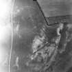
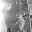
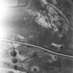
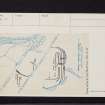
Crop-marks of a Roman fort, on Whitemoss farm, were noted by Dr Steer on aerial photographs (CPE/Scot/UK 276: 5253-4) in 1949. The site commands a magnificent vista across and along the Clyde, and the finding of a fort there helps to solve the problem of the defence of the W flank of the Antonine Wall where, in Roman times, the Clyde did not constitute a military obstacle, being shallow and in places fordable. Two Antonine samian fragments, found on the surface are in the Hunterian Museum, Glasgow.
K A Steer 1951; information from A S Robertson, 1951.
In 1950 trenching discovered (1) An E-W ditch, possibly the N side of the fort, with a heavily metalled road passing through a gap in it, opposite the entrance on the S side; several Antonine sherds were found in the ditch. (2) A system of fortifications to the NW apparently unconnected with the other part and indicating more than one fort of more than one period.
F Newall 1950.
In 1952 the plan of the fort was 'completed' (but plan shows the SE portion only). The S gate showed two periods, both Antonine, and the only finds were of Antonine date.
F Newall 1953.
In 1953 excavation of the headquarters building was completed and four different periods were observed (the report gives no reason to suppose that any of the periods were other than Antonine).The third period had ended in destruction by fire.
F Newall 1954.
In 1954 the foundations of a barrack block and an unspecified building were traced.
F Newall 1955.
No traces of this fort are visible on the ground.
Visited by OS (WDJ), 12 May 1964.
On air photographs, a ditch was located running from the NW angle of the fort for some distance down the slope to the N. It may enclose an annexe.
J K St Joseph 1958.
Photographed by the RCAHMS and CUCAP.
(Undated) information in NMRS.
Scheduled as 'Whitemoss Roman Fort, 175m SW of Rosarymount... the buried remains of a Roman fort and attached annex[e], visible from the air as cropmarks indicating the extent of the defensive ditches and some internal features.'
Information from Historic Scotland, scheduling document dated 11 February 2011.
Reference (1957)
This site is noted in the ‘List of monuments discovered during the survey of marginal land (1951-5)’ (RCAHMS 1957, xiv-xviii).
Information from RCAHMS (GFG), 24 October 2012.
Archaeological Evaluation (2002)
NS 420 719: evaluation of an area of level ground 100m south east of Whitemoss Fort found no trace of any Roman Activity.
Information from FIRAT Archaeological Services.
Watching Brief (16 November 2016)
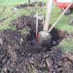
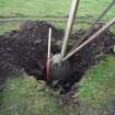
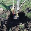
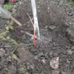
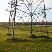
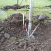
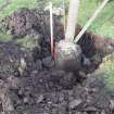
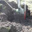
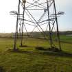
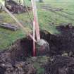
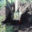
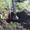
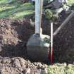
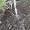
NS 41826 72096 A watching brief was carried out on 16 November 2016 during pylon foundation repair works under scheduled monument consent at Whitemoss Roman Fort. The excavated areas at all four corners of the pylon were monitored and spoil was metal detected. All work took place on ground previously disturbed to erect the pylon, and natural subsoil was not reached. No archaeological finds or features were uncovered.
Archive: NRHE (intended). Report: WoSAS
Funder: Scottish Power Energy Networks
Tomasz Jenorowski – CFA Archaeology Ltd
(Source: DES, Volume 18)


